| << Portugal: Amtliche topografische Landkarten des Instituto Geográfico do Exército (IGeoE) 1:25.000 (Serie M888) |
||
|
||

Zuletzt angesehene Artikel:
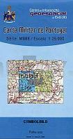
 | 484 - Topographische Landkarte Portugal 1:25.000 Carta Militar de Portugal - Série M888 Instituto Geográfico do Exército (IGeoE) - Portugal |
 | Insel Ugljan (Blatt 21) Topographische Wanderkarte 1:25.000 - Serija Dinarske Alpe Otok Ugljan - Serija Dinarske Alpe - Mountaineering and Hiking map - Croatian Mountain Rescue Service Kroatischer Bergrettungsdienst - Kroatien |
 | Harzer Hexen-Stieg 1:30.000 (GPS) Offizielle Karte zum anerkannten Prädikatswanderweg im Harz - von Bernhard Spachmüller Schmidt-Buch-Verlag |
 | Patagonien Südliches Eisfeld - Monte Fitz Roy Wanderkarte - Bergwanderkarte 1:50.000 Argentinien / Chile Patagonian South Icefield ZAGIER & URRUTY PUBLICATIONS |
 | Klagenfurt und Umgebung (2 Karten) 1:50.000 (Nr. 294) inklusive Karte in der KOMPASS-App offline nutzen, markierte Wanderwege, Fahrradfahren - Wanderkarten-Set - KOMPASS-Karten |
 | 199-2 VILLEGAS Amtliche topographische Landkarte 1:25.000 Spanien (M.T.N.) 199-2 Mapa Topográfico Nacional de Espana (MTN25) Instituto Geográfico Nacional - CNIG Spanien |
 | 57 Ãrebro 1:50.000 (wasserfest) Topographische Wanderkarte - Sverigeserien Topo50 - Schweden Kartförlaget |
 | 0695-3 COLONIA DEL ROMERAL Topographische Landkarte 1:25.000 Spanien (Grundlage MTN25) Instituto Geográfico Nacional - CNIG Spanien - ProjektNord |
 | Erlebniskarte Illustrierte Deutschlandkarte politisch - ca. 100 x 70 cm POSTER - Krüger & Schönhoff druckbunt Verlag |
 | M4133 Lammi Topographische Karte 1:25.000 EUREF (Peruskartta) Maanmittauslaitos / Lantmäteriverket Finnland - ProjektNord |
 | 0052-3 SANTIANES Topographische Landkarte 1:25.000 Spanien (Grundlage MTN25) Instituto Geográfico Nacional - CNIG Spanien - ProjektNord |
 | Region Dresden 1:200.000 Topographische StraÃenkarte ProjektNord - Bundesamt f. Kartographie u. Geodäsie |
 | 32-2 Česke Budĕjovice (Böhmisch Budweis) Topographische Karte 1:100.000 der Tschechischen Republik Zakladnà mapa Ceská republika - Cesky urad zememericky a katastralni - ProjektNord |
 | Oberes Florentiner Arno-Tal Topographische Landkarte Toskana 1:30.000 engl./ital.) Edizioni Abies Carta Turistico - Escursionisica del Valdarno Superiore Fiorentino |
 | VIA CZECHIA Central Trail - Kartenset Teil 1 (C 1-9) Topographische Wanderkarte 1:25.000 EUROKART (tschechisch) VIA CZECHIA - Centrálnà stezka, Z nejzápadnějšÃho bodu ČR do Davle Geodezie On Line - Tschechien |
 | GG00 GÃTEBORGSSERIEN Topographische Wanderkarten 1:50.000 - Kartenserie GÃTEBORGSSERIEN - Kartserie, Terrängkarta UTEKARTAN - Schweden |