| << Portugal: Amtliche topografische Landkarten des Instituto Geográfico do Exército (IGeoE) 1:25.000 (Serie M888) |
||
|
||

Zuletzt angesehene Artikel:
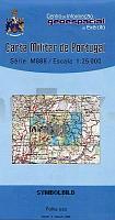
 | 491 - Topographische Landkarte Portugal 1:25.000 Carta Militar de Portugal - Série M888 Instituto Geográfico do Exército (IGeoE) - Portugal |
 | Siegerland 1 (Blatt West) Topographische Wanderkarte Nordrhein-Westfalen mit Wanderwegen und Radwegen 1:25.000 - ProjektNord |
 | 374 - Topographische Landkarte Portugal 1:25.000 Carta Militar de Portugal - Série M888 Instituto Geográfico do Exército (IGeoE) - Portugal |
 | 4345-SO Topographische Karte 1:10.000 - Landesvermessungsamt Brandenburg |
 | Q5132 Ãlänne Topographische Karte 1:25.000 EUREF (Peruskartta) Maanmittauslaitos / Lantmäteriverket Finnland - ProjektNord |
 | 6006 Landscheid - Wanderkarte mit Wanderwegen (geplottete Ausgabe) ProjektNord - Grundlage Amtliche topographische Karte Landesamt für Vermessung und Geobasisinformation Rheinland-Pfalz |
 | 2114-II-Sà Topographische Karte Dänemark 1:25.000 Topografisk kort Danmark (DTK/Kort25) 2114-II-Sà ProjektNord - Kort & Matrikelstyrelsen / Geodætisk Institut |
 | Seattle 1:10.000 *** SCHNÃPPCHEN *** Stadtplan Borch laminiert |
 | 342 - Topographische Landkarte Portugal 1:25.000 Carta Militar de Portugal - Série M888 Instituto Geográfico do Exército (IGeoE) - Portugal |
 | 239 Pradoluengo Amtliche topographische Landkarte 1:50.000 Spanien (M.T.N.) 239 Mapa Topográfico Nacional de Espana (MTN50) Instituto Geográfico Nacional - CNIG Spanien |
 | U5412 Topographische Karte 1:25.000 EUREF (Peruskartta) Maanmittauslaitos / Lantmäteriverket Finnland - ProjektNord |
 | 1002 Dos Hermanas Amtliche topographische Landkarte 1:50.000 Spanien (M.T.N.) 1002 Mapa Topográfico Nacional de Espana (MTN50) Instituto Geográfico Nacional - CNIG Spanien |
 | 277 - Topographische Landkarte Portugal 1:25.000 Carta Militar de Portugal - Série M888 Instituto Geográfico do Exército (IGeoE) - Portugal |
 | Finale Ligure 1:8.000 Trekking Liguria Outdoor Finale Ligure trekking. Carta dei sentieri - Sentieri e passeggiate di Liguria EdM - Edizioni del Magistero - Italien |
 | 809-3 VALDEAZOGUES Amtliche topographische Landkarte 1:25.000 Spanien (M.T.N.) 809-3 Mapa Topográfico Nacional de Espana (MTN25) Instituto Geográfico Nacional - CNIG Spanien |
 | West-Finnland GT 1:250.000 Utflyktskarta - Outdoorkarte - Freizeitkarte - Fahrradkarte Länsi-Suomi Retkeily GT Karttakeskus / Genimap Finnland |
 | 381 Monte Rosa 1:25.000 - Alte valli di Ayas e di Gressoney - Wanderkarte 4land Carta Topografica Escursionistica 4land |
 | 18 - Topographische Landkarte Portugal 1:25.000 Carta Militar de Portugal - Série M888 Instituto Geográfico do Exército (IGeoE) - Portugal |
 | S4343 Livo Topographische Karte 1:25.000 EUREF (Peruskartta) Maanmittauslaitos / Lantmäteriverket Finnland - ProjektNord |
 | 105B13 - Caribou Lakes Topographische Landkarte 1:50.000 - Canada - Yukon |