| << Portugal: Amtliche topografische Landkarten des Instituto Geográfico do Exército (IGeoE) 1:25.000 (Serie M888) |
||
|
||

Zuletzt angesehene Artikel:
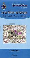
 | 503 - Topographische Landkarte Portugal 1:25.000 Carta Militar de Portugal - Série M888 Instituto Geográfico do Exército (IGeoE) - Portugal |
 | 687-2 VILLACAÃAS Amtliche topographische Landkarte 1:25.000 Spanien (M.T.N.) 687-2 Mapa Topográfico Nacional de Espana (MTN25) Instituto Geográfico Nacional - CNIG Spanien |
 | 0513-2 ZAOREJAS Topographische Landkarte 1:25.000 Spanien (Grundlage MTN25) Instituto Geográfico Nacional - CNIG Spanien - ProjektNord |
 | 0379-3 NEPAS Topographische Landkarte 1:25.000 Spanien (Grundlage MTN25) Instituto Geográfico Nacional - CNIG Spanien - ProjektNord |
 | 47 Krautsand - Varendorfsche Karte 1789-1792 Topographisch Militärische Charte des Herzogtums Holstein - Reproduktion 1:25.000 |
 | 0525-4 LA ENCINA Topographische Landkarte 1:25.000 Spanien (Grundlage MTN25) Instituto Geográfico Nacional - CNIG Spanien - ProjektNord |
 | 0990 ALCALà LA REAL Topographische Landkarte 1:50.000 Spanien (Grundlage MTN50) Instituto Geográfico Nacional - CNIG Spanien - ProjektNord |
 | Q5331 Hattuselkonen Topographische Karte 1:25.000 EUREF (Peruskartta) Maanmittauslaitos / Lantmäteriverket Finnland - ProjektNord |
 | 3611 Hopsten (geplottete Ausgabe) Amtliche topographische Karte 1:25.000 Landesvermessungsamt Nordrhein-Westfalen |
 | Hoher Fläming, Bad Belzig, Beelitz und Umgebung - GroÃe Wander- und Radwanderkarte 1:50.000 (Nr. 154) Ausflüge zwischen Ziesar, Niemegk, Treuenbrietzen, Brück, Wiesenburg/Mark, Kropstädt und Rabenstein. GroÃe Radwander- und Wanderkarte, Alle Radtourenvorschläge mit Entfernungsangaben in Kilometern. GPS-fähig Dr. Barthel Verlag |
 | 0598-2 EL TORNO Topographische Landkarte 1:25.000 Spanien (Grundlage MTN25) Instituto Geográfico Nacional - CNIG Spanien - ProjektNord |
 | 0311-3 AMPUDIA Topographische Landkarte 1:25.000 Spanien (Grundlage MTN25) Instituto Geográfico Nacional - CNIG Spanien - ProjektNord |
 | 358 - Topographische Landkarte Portugal 1:25.000 Carta Militar de Portugal - Série M888 Instituto Geográfico do Exército (IGeoE) - Portugal |
 | Südtirol - Trentino Natur und Kultur zwischen Vinschgau und Dolomiten - von Gunnar Strunz - TRESCHER |
| NJ 35-8 Usak Amtliche Topographische Karte der Türkei 1:250.000 NJ 35-8 Uşak - Müşterek Harekat Haritası HGK |
 | 0203-4 ENTRENA Topographische Landkarte 1:25.000 Spanien (Grundlage MTN25) Instituto Geográfico Nacional - CNIG Spanien - ProjektNord |
 | 0560-3 MEJORADA DEL CAMPO Topographische Landkarte 1:25.000 Spanien (Grundlage MTN25) Instituto Geográfico Nacional - CNIG Spanien - ProjektNord |
 | N5431 Onkamo Topographische Karte 1:25.000 EUREF (Peruskartta) Maanmittauslaitos / Lantmäteriverket Finnland - ProjektNord |
 | 0626-3 ALCAÃIZO Topographische Landkarte 1:25.000 Spanien (Grundlage MTN25) Instituto Geográfico Nacional - CNIG Spanien - ProjektNord |
 | 0603-2 SANTA CRUZ DEL RETAMAR Topographische Landkarte 1:25.000 Spanien (Grundlage MTN25) Instituto Geográfico Nacional - CNIG Spanien - ProjektNord |