| << Portugal: Amtliche topografische Landkarten des Instituto Geográfico do Exército (IGeoE) 1:25.000 (Serie M888) |
||
|
||

Zuletzt angesehene Artikel:
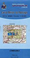
 | 519 - Topographische Landkarte Portugal 1:25.000 Carta Militar de Portugal - Série M888 Instituto Geográfico do Exército (IGeoE) - Portugal |
 | 3350-SO Topographische Karte 1:10.000 - Landesvermessungsamt Brandenburg |
 | 0444-4 CABACÃS Topographische Landkarte 1:25.000 Spanien (Grundlage MTN25) Instituto Geográfico Nacional - CNIG Spanien - ProjektNord |
 | 500 Topographische Landkarte Wanderkarte und Fahrradkarte Portugal 1:25.000 500 Mapa topográfico - Mapa de caminhadas - Portugal 1:25.000 ProjektNord |
 | 522 Topographische Landkarte Wanderkarte und Fahrradkarte Portugal 1:25.000 522 Mapa topográfico - Mapa de caminhadas - Portugal 1:25.000 ProjektNord |
 | 0777 MÃRIDA Topographische Landkarte 1:50.000 Spanien (Grundlage MTN50) Instituto Geográfico Nacional - CNIG Spanien - ProjektNord |
| 1311-II Bagenkop Topographische Karte Dänemark 1:50.000 Kort & Matrikelstyrelsen / Geodætisk Institut |
 | 0643 SA CALOBRA Topographische Landkarte 1:50.000 Spanien (Grundlage MTN50) Instituto Geográfico Nacional - CNIG Spanien - ProjektNord |
 | 948 Bedmar Amtliche topographische Landkarte 1:50.000 Spanien (M.T.N.) 948 Mapa Topográfico Nacional de Espana (MTN50) Instituto Geográfico Nacional - CNIG Spanien |
 | C4710 Dortmund (geplottete Ausgabe) *** SCHNÃPPCHEN *** Topographische Landkarte 1:100.000 Landesvermessungsamt Nordrhein-Westfalen |
 | 230 Castrocontrigo Amtliche topographische Landkarte 1:50.000 Spanien (M.T.N.) 230 Mapa Topográfico Nacional de Espana (MTN50) Instituto Geográfico Nacional - CNIG Spanien |
 | 216 (35-10) Bellver de Cerdanya Amtliche topographische Landkarte 1:50.000 Spanien (M.T.N.) 216 Mapa Topográfico Nacional de Espana (MTN50) Instituto Geográfico Nacional - CNIG Spanien |
 | 6911 Ludwigswinkel - Wanderkarte mit Wanderwegen (geplottete Ausgabe) ProjektNord - Grundlage Amtliche topographische Karte Landesamt für Vermessung und Geobasisinformation Rheinland-Pfalz |
 | 952 Vélez-Blanco Amtliche topographische Landkarte 1:50.000 Spanien (M.T.N.) 952 Mapa Topográfico Nacional de Espana (MTN50) Instituto Geográfico Nacional - CNIG Spanien |
| CC 5518 Fulda Bodenübersichtskarte 1:200.000 - Bundesanstalt für Geowissenschaften und Rohstoffe (BGR) |
 | 889 Moratalla Amtliche topographische Landkarte 1:50.000 Spanien (M.T.N.) 889 Mapa Topográfico Nacional de Espana (MTN50) Instituto Geográfico Nacional - CNIG Spanien |
 | 454 Setúbal Topographische Landkarte Portugal 1:25.000 Carta Militar de Portugal - Série M888 Instituto Geográfico do Exército (IGeoE) - Portugal |
| 2845-SO Topographische Karte 1:10.000 - Landesvermessungsamt Brandenburg |
 | 6008 Bernkastel-Kues - Wanderkarte mit Wanderwegen (geplottete Ausgabe) ProjektNord - Grundlage Amtliche topographische Karte Landesamt für Vermessung und Geobasisinformation Rheinland-Pfalz |
| 02-24-01 Topographische Karte 1:10.000 der Tschechischen Republik Zakladnà mapa Ceská republika - Cesky urad zememericky a katastralni - ProjektNord |