Willkommen bei MapFox
Wurde Ihre Bestellung bestätigt? Wenn nicht - gab es evtl. ein SERVER-Problem! Bitte kontaktieren Sie uns! +++ Buchhändler-Anfragen erwünscht +++
Warenkorb
Artikel: 0 - € 0.00
Zur Kasse
Impressum Kontakt Versandkosten AGB
537 - Topographische Landkarte Portugal 1:25.000 Carta Militar de Portugal - Série M888 Instituto Geográfico do Exército (IGeoE) - Portugal
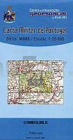
<< Portugal: Amtliche topografische Landkarten des Instituto Geográfico do Exército (IGeoE) 1:25.000 (Serie M888)
 
Cover

Gesamtliste mit Blattübersicht

Kartenbeispiel aus der Serie

Kartenausschnitt

537 - Topographische Landkarte Portugal 1:25.000 Carta Militar de Portugal - Série M888 Instituto Geográfico do Exército (IGeoE) - Portugal
Preis: EUR 17.90

Bestellartikel: versandfertig in ca. 2 Wochen oder länger. Dieser Artikel wird speziell für Sie bestellt. Keine Rücknahme!
Produkt EUR Anzahl Bestellen
537 - Topographische Landkarte Portugal 1:25.000 Carta Militar de Portugal - Série M888 Instituto Geográfico do Exército (IGeoE) - Portugal 17.90
Versandkostenfrei in Deutschland ab 30,- Bestellwert

incl. MwSt.

Stichworte, die bei der Suche nützlich sein könnten:
Portugal - topografische Wanderkarten - Serie M888 - Série M888 - M888

Zuletzt angesehene Artikel:

Cover537 - Topographische Landkarte Portugal 1:25.000 Carta Militar de Portugal - Série M888 Instituto Geográfico do Exército (IGeoE) - Portugal

CoverAdria-Ostküste Vögel beobachten und Natur erleben in historischen Landschaften am Mittelmeer - von Schneider-Jacoby, Martin Stumberger, Borut - EuroNatur Service

Cover945-1 PRÁGDENA Amtliche topographische Landkarte 1:25.000 Spanien (M.T.N.)
945-1 Mapa Topográfico Nacional de Espana (MTN25) Instituto Geográfico Nacional - CNIG Spanien

Cover1003-3 UTRERA Amtliche topographische Landkarte 1:25.000 Spanien (M.T.N.)
1003-3 Mapa Topográfico Nacional de Espana (MTN25) Instituto Geográfico Nacional - CNIG Spanien

Cover467-3 MUNIESA Amtliche topographische Landkarte 1:25.000 Spanien (M.T.N.)
467-3 Mapa Topográfico Nacional de Espana (MTN25) Instituto Geográfico Nacional - CNIG Spanien

Cover20D LELYSTAD WEST Topographische Karte der Niederlande 1:25.000 (Plotausgabe)
20D LELYSTAD WEST Topografische Kaart van Nederland Kadaster - ProjektNord

CoverUmgebung Bielitz-Biala Topographische Wanderkarte Polen 1:50.000
Okolice Bielska-Białej - mapa topograficzno-turystyczna (GPS) - WZKART Polen

Cover189-2 QUIROGA Amtliche topographische Landkarte 1:25.000 Spanien (M.T.N.)
189-2 Mapa Topográfico Nacional de Espana (MTN25) Instituto Geográfico Nacional - CNIG Spanien

Cover5324 Hünfeld - Wanderkarte mit Wanderwegen (geplottete Ausgabe) Topographische Landkarte Hessen 1:25.000 - ProjektNord (geplottete Ausgabe)

Cover253-4 ORGANYÁ Amtliche topographische Landkarte 1:25.000 Spanien (M.T.N.)
253-4 Mapa Topográfico Nacional de Espana (MTN25) Instituto Geográfico Nacional - CNIG Spanien

CoverS5222 Porosaari Topographische Karte 1:25.000 EUREF (Peruskartta) Maanmittauslaitos / Lantmäteriverket Finnland - ProjektNord

Cover942-3 EL PRIORATO Amtliche topographische Landkarte 1:25.000 Spanien (M.T.N.)
942-3 Mapa Topográfico Nacional de Espana (MTN25) Instituto Geográfico Nacional - CNIG Spanien

CoverN5313 Kerimäki Topographische Karte 1:25.000 EUREF (Peruskartta) Maanmittauslaitos / Lantmäteriverket Finnland - ProjektNord

Cover6714 Edenkoben - Wanderkarte mit Wanderwegen (geplottete Ausgabe) ProjektNord - Grundlage Amtliche topographische Karte Landesamt für Vermessung und Geobasisinformation Rheinland-Pfalz

Cover271-2 MAYORGA Amtliche topographische Landkarte 1:25.000 Spanien (M.T.N.)
271-2 Mapa Topográfico Nacional de Espana (MTN25) Instituto Geográfico Nacional - CNIG Spanien

Cover181-4 ESPOT Amtliche topographische Landkarte 1:25.000 Spanien (M.T.N.)
181-4 Mapa Topográfico Nacional de Espana (MTN25) Instituto Geográfico Nacional - CNIG Spanien

Cover638-4 ALPUENTE Amtliche topographische Landkarte 1:25.000 Spanien (M.T.N.)
638-4 Mapa Topográfico Nacional de Espana (MTN25) Instituto Geográfico Nacional - CNIG Spanien

Cover1004-1 MARCHENA Amtliche topographische Landkarte 1:25.000 Spanien (M.T.N.)
1004-1 Mapa Topográfico Nacional de Espana (MTN25) Instituto Geográfico Nacional - CNIG Spanien

CoverATLAS DR 1987 - Eisenbahnstreckenlexikon der Deutschen Reichsbahn 1:300.000 EISENBAHN-VERKEHRSKARTE - Gesamtes Eisenbahnnetz der Deutschen Demokratischen Republik (DDR) - von Harald Rockstuhl (Herausgeber + Illustrator) - Verlag Rockstuhl - von Harald Rockstuhl (Herausgeber + Illustrator) - Verlag Rockstuhl

Cover0983 SANLÚCAR LA MAYOR Topographische Landkarte 1:50.000 Spanien (Grundlage MTN50) Instituto Geográfico Nacional - CNIG Spanien - ProjektNord