| << Portugal: Amtliche topografische Landkarten des Instituto Geográfico do Exército (IGeoE) 1:25.000 (Serie M888) |
||
|
||

Zuletzt angesehene Artikel:
 | 547 - Panóias Topographische Landkarte Portugal 1:25.000 Carta Militar de Portugal - Série M888 Instituto Geográfico do Exército (IGeoE) - Portugal |
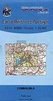
 | 87 - Topographische Landkarte Portugal 1:25.000 Carta Militar de Portugal - Série M888 Instituto Geográfico do Exército (IGeoE) - Portugal |
 | 0625-3 PERALEDA DE LA MATA Topographische Landkarte 1:25.000 Spanien (Grundlage MTN25) Instituto Geográfico Nacional - CNIG Spanien - ProjektNord |
 | 220 Topographische Landkarte Wanderkarte und Fahrradkarte Portugal 1:25.000 220 Mapa topográfico - Mapa de caminhadas - Portugal 1:25.000 ProjektNord |
 | 0370 TORO Topographische Landkarte 1:50.000 Spanien (Grundlage MTN50) Instituto Geográfico Nacional - CNIG Spanien - ProjektNord |
 | 181 Esterrid Aneu Amtliche topographische Landkarte 1:50.000 Spanien (M.T.N.) 181 Mapa Topográfico Nacional de Espana (MTN50) Instituto Geográfico Nacional - CNIG Spanien |
 | 0623-3 VILLARREAL DE SAN CARLOS Topographische Landkarte 1:25.000 Spanien (Grundlage MTN25) Instituto Geográfico Nacional - CNIG Spanien - ProjektNord |
 | 222-223 Vigo Amtliche topographische Landkarte 1:50.000 Spanien (M.T.N.) 222-223 Mapa Topográfico Nacional de Espana (MTN50) Instituto Geográfico Nacional - CNIG Spanien |
 | 0821-1 MURO DE ALCOY Topographische Landkarte 1:25.000 Spanien (Grundlage MTN25) Instituto Geográfico Nacional - CNIG Spanien - ProjektNord |
 | 5520 Nidda - Wanderkarte mit Wanderwegen (geplottete Ausgabe) Topographische Landkarte Hessen 1:25.000 - ProjektNord (geplottete Ausgabe) |
 | 908-2 SANTIAGO DE LA ESPADA Amtliche topographische Landkarte 1:25.000 Spanien (M.T.N.) 908-2 Mapa Topográfico Nacional de Espana (MTN25) Instituto Geográfico Nacional - CNIG Spanien |
 | 0266-3 A GUDIÃA Topographische Landkarte 1:25.000 Spanien (Grundlage MTN25) Instituto Geográfico Nacional - CNIG Spanien - ProjektNord |
 | 0550 FUENTEGUINALDO Topographische Landkarte 1:50.000 Spanien (Grundlage MTN50) Instituto Geográfico Nacional - CNIG Spanien - ProjektNord |
 | 0507-4 EL ESPINAR Topographische Landkarte 1:25.000 Spanien (Grundlage MTN25) Instituto Geográfico Nacional - CNIG Spanien - ProjektNord |
 | 0069-3 SANTA COMBA Topographische Landkarte 1:25.000 Spanien (Grundlage MTN25) Instituto Geográfico Nacional - CNIG Spanien - ProjektNord |
 | 0178 BROTO Topographische Landkarte 1:50.000 Spanien (Grundlage MTN50) Instituto Geográfico Nacional - CNIG Spanien - ProjektNord |
 | 0575 HERVÃS Topographische Landkarte 1:50.000 Spanien (Grundlage MTN50) Instituto Geográfico Nacional - CNIG Spanien - ProjektNord |
 | 0398 CASTRONUÃO Topographische Landkarte 1:50.000 Spanien (Grundlage MTN50) Instituto Geográfico Nacional - CNIG Spanien - ProjektNord |
 | 3744-NW Topographische Karte 1:10.000 - Landesvermessungsamt Brandenburg |
 | 0224-4 A CAÃIZA Topographische Landkarte 1:25.000 Spanien (Grundlage MTN25) Instituto Geográfico Nacional - CNIG Spanien - ProjektNord |