
| << Portugal: Amtliche topografische Landkarten des Instituto Geográfico do Exército (IGeoE) 1:25.000 (Serie M888) |
||
|
||


Zuletzt angesehene Artikel:
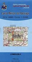
 | 579 Sao Barnabe (Almodovar) Topographische Landkarte Portugal 1:25.000 Carta Militar de Portugal - Série M888 Instituto Geográfico do Exército (IGeoE) - Portugal |
 | 5803 Leidenborn - Wanderkarte mit Wanderwegen (geplottete Ausgabe) ProjektNord - Grundlage Amtliche topographische Karte Landesamt für Vermessung und Geobasisinformation Rheinland-Pfalz |
 | 555 - Topographische Landkarte Portugal 1:25.000 Carta Militar de Portugal - Série M888 Instituto Geográfico do Exército (IGeoE) - Portugal |
 | 130 - Torre de Moncorvo Topographische Landkarte Portugal 1:25.000 Carta Militar de Portugal - Série M888 Instituto Geográfico do Exército (IGeoE) - Portugal |
 | Joensuu guidemap 1:15.000 *** SCHNÄPPCHEN *** Stadtplan Finnland Joensuu opaskartta |
 | 0242-2 OCÓN Topographische Landkarte 1:25.000 Spanien (Grundlage MTN25) Instituto Geográfico Nacional - CNIG Spanien - ProjektNord |
 | U4132 Sieppijärvi Topographische Karte 1:25.000 EUREF (Peruskartta) Maanmittauslaitos / Lantmäteriverket Finnland - ProjektNord |
 | Trekking in den Turiner Alpen - 12 ausgesuchte Wanderungen zwischen 3 und 6 Tagen in den Turiner Alpen - von Gian Luca Boetti - Wanderführer Italien - Versante Sud |
| L-33-71 Nagyatad Amtliche Topographische Karte Ungarn 1:100.000 |
 | 470 - Topographische Landkarte Portugal 1:25.000 Carta Militar de Portugal - Série M888 Instituto Geográfico do Exército (IGeoE) - Portugal |
 | 0346-2 BAÑOS DE VALDEARADOS Topographische Landkarte 1:25.000 Spanien (Grundlage MTN25) Instituto Geográfico Nacional - CNIG Spanien - ProjektNord |
 | U4311 Jääskö Topographische Karte 1:25.000 EUREF (Peruskartta) Maanmittauslaitos / Lantmäteriverket Finnland - ProjektNord |
 | 2414-II - mit Wanderwegen und Fahrradrouten Topographische Fahrradkarte und Wanderkarte Dänemark 1:50.000 - Kort & Matrikelstyrelsen ProjektNord 2414-II - Topografisk Cykel- og Vandrekort Danmark |
 | 185 - Topographische Landkarte Portugal 1:25.000 Carta Militar de Portugal - Série M888 Instituto Geográfico do Exército (IGeoE) - Portugal |
 | Koblenz - Bonn - Mainz - Mittelrheintal *** SCHNÄPPCHEN *** ADFC-Regionalkarte 1:75.000 BVA Bielefelder Verlag |
 | 304 - Topographische Landkarte Portugal 1:25.000 Carta Militar de Portugal - Série M888 Instituto Geográfico do Exército (IGeoE) - Portugal |
 | Rhein-Main 1:50.000 *** SCHNÄPPCHEN *** Rad- und Freizeitkarte - GeoMap |
 | 5213 Betzdorf - Wanderkarte mit Wanderwegen (geplottete Ausgabe) ProjektNord - Grundlage Amtliche topographische Karte Landesamt für Vermessung und Geobasisinformation Rheinland-Pfalz |
| 3752-NO Topographische Karte 1:10.000 - Landesvermessungsamt Brandenburg |
 | N3422 Horonkylä Topographische Karte 1:25.000 EUREF (Peruskartta) Maanmittauslaitos / Lantmäteriverket Finnland - ProjektNord |