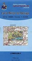
| << Portugal: Amtliche topografische Landkarten des Instituto Geográfico do Exército (IGeoE) 1:25.000 (Serie M888) |
||
|
||

Zuletzt angesehene Artikel:
 | 602 Lagos Topographische Landkarte Portugal 1:25.000 Carta Militar de Portugal - Série M888 Instituto Geográfico do Exército (IGeoE) - Portugal |
 | L-34-32-A Berettyoujfalu Amtliche Topographische Karte Ungarn 1:50.000 |
 | Sisimiut 1:100.000 Wanderkarte Westgrönland - Vandrekort Vestgrønland Greenland Tourism (Blatt 10) |
 | La Porta del Cel 1:25.000 Wanderkarte Spanien - ALPINA |
 | 474 - Topographische Landkarte Portugal 1:25.000 Carta Militar de Portugal - Série M888 Instituto Geográfico do Exército (IGeoE) - Portugal |
 | N4211 Kurjenkylä Topographische Karte 1:25.000 EUREF (Peruskartta) Maanmittauslaitos / Lantmäteriverket Finnland - ProjektNord |
 | Mit dem Wohnmobil nach Thüringen (Band 9) *** SCHNÃPPCHEN *** Die Anleitung für einen Erlebnisurlaub. Tipps, Tricks, Touren, Tolle Plätze. Alle Plätze mit präzisen GPS-Daten - von Reinhard Schulz und Waltraud Roth-Schulz - WOMO-Verlag |
| L2546 Woldegk Topographische Karte 1:50.000 (Regelblattschnitt) Landesvermessungsamt Brandenburg |
 | Vilnius (Wilna) *** SCHNÃPPCHEN *** Taschenstadtplan 1:50.000 (Litauen) - Jana Seta Vilnius |
 | Italien Mitte und Nord (Blatt 1) StraÃenkarte 1:500.000 Italia centro nord Touring-Club Italiano (TCI) Italien |
 | 357 - Topographische Landkarte Portugal 1:25.000 Carta Militar de Portugal - Série M888 Instituto Geográfico do Exército (IGeoE) - Portugal |
 | Lonely Planet Reiseführer Dubai & Abu Dhabi Lonely Planet Reiseführer - Josephine Quintero - Jessica Lee - Andrea Schulte-Peevers - MAIRDUMONT |
 | P521 Lapinlahti Topographische Karte 1:50.000 EUREF-FIN (Maastokarttat) Maanmittauslaitos / Lantmäteriverket Finnland - ProjektNord |
 | N3144 Skaftung Topographische Karte 1:25.000 EUREF (Peruskartta) Maanmittauslaitos / Lantmäteriverket Finnland - ProjektNord |
 | Die Haard Topographische Wanderkarte Nordrhein-Westfalen mit Wanderwegen und Radwegen 1:25.000 - ProjektNord |
| 3446-NO Topographische Karte 1:10.000 - Landesvermessungsamt Brandenburg |
 | Monti Reatini - Terminillo (Blatt 15) Wanderkarte 1:25.000 Edizioni Il Lupo Carta Escursionistica |
 | 48 - Topographische Landkarte Portugal 1:25.000 Carta Militar de Portugal - Série M888 Instituto Geográfico do Exército (IGeoE) - Portugal |
 | 6125 Würzburg Nord Topographische Landkarte Bayern 1:25.000 - Normalausgabe - ProjektNord (geplottete Ausgabe) - Grundlage amtliche Topographische Karte Bayern DTK25 |
 | Die Erde politisch 1:60 Mio. mit Flaggen (53 x 68 cm) *** SCHNÃPPCHEN *** WANDKARTE mit Metallleisten - Craenen BVBA (englisch) |