 Dies ist eine hochwertige Landkartenserie, die sich besonders zum Radwandern und zum Weitwandern eignet. Die topographischen Karten enthalten Radwanderwege, überregionale Wanderwege und touristische Informationen.  Blattschnitte Blattschnitte
Kartenbeispiel HINWEIS: Ab 2024 wird diese Serie nicht mehr fortgeführt, sondern duch einen neuen Blattschnitt ersetzt, der sich an den Départementgrenzen orientiert. Restbestände der alten Serie sind noch lieferbar. Kartenausschnitt
|
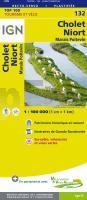
132 Cholet - Niort Topographische Touristische Landkarte Tourismus und Fahrrad (wasserfest) - tourisme et vélo plastifiée TOP100 - 1:100.000 - IGN Frankreich
EAN / ISBN: 9782758543725
Preis: EUR 11.50
|
| 

