Willkommen bei MapFox
+++ Buchhändleranfragen willkommen! Tel. 0431-666 75 99 +++
Warenkorb
Artikel: 0 - € 0.00
Zur Kasse
Impressum Kontakt Versandkosten AGB
1332ET ROYAN - Foret-de-la-Coubre - Topographische Wanderkarte Frankreich 1:25.000 *** SCHNÄPPCHEN *** TOP 25 IGN - (GPS)
<< Frankreich: Topographische Wanderkarten des IGN 1:25.000 - TOP25
<< Schnäppchen - Restposten - Mängelexemplare
 
(Titelbild evtl. abweichend)
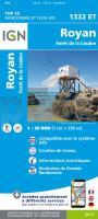
Cover

Altauflage 2005 + leicht beschädigt, daher zum Sonderpreis.

Erstklassige, hochdetaillierte topographische Wanderkarte im Maßstab 1:25.000. Die Höhenlinien liegen im 10 m-Abstand. Mit UTM-Gitter für GPS. Die Wanderwege sind exakt eingezeichnet. Weitere Inhalte: Gîtes d`etappe, Zeltplätze, (bei Flüssen: Einsetzstellen für Kanuwanderer). Die Legende liegt auf französisch und englisch vor.

Übersicht der TOP 25-Karten und zahlreicher série bleue-Karten

Da nicht alle série bleue-Karten in der Übersicht erkennbar sind, erbitten wir Ihre spezielle Anfrage per Email.

Beispiel aus einer TOP25 Karte dieser Serie

Klicken Sie hier, wenn Sie diesen Artikel in der Version zum normalen Preis sehen möchten.

Kartenausschnitt

1332ET ROYAN - Foret-de-la-Coubre - Topographische Wanderkarte Frankreich 1:25.000 *** SCHNÄPPCHEN *** TOP 25 IGN - (GPS)
EAN / ISBN: 9782758557173
Preis: EUR 10.00

sofort versandfertig Dieser Artikel ist im Normalfall sofort lieferbar.
Produkt EUR Anzahl Bestellen
1332ET ROYAN - Foret-de-la-Coubre - Topographische Wanderkarte Frankreich 1:25.000 *** SCHNÄPPCHEN *** TOP 25 IGN - (GPS) 10.00
Versandkostenfrei in Deutschland ab 20,- Bestellwert

incl. MwSt.

Stichworte, die bei der Suche nützlich sein könnten:
Royan - Foret-de-la-Coubre - TOP 25 (IGN) - Frankreich - Frankreich Landkarten - Frankreich topographische Landkarten - Frankreich IGN - Frankreich Wanderkarten - serie bleue (IGN) - série bleue (IGN) - IGN - Institut Geographique National (Frankreich) - IGN (Frankreich) - France carte - Schnäppchen - Sonderangebote - Restposten

Zuletzt angesehene Artikel:

Cover1332ET ROYAN - Foret-de-la-Coubre - Topographische Wanderkarte Frankreich 1:25.000 *** SCHNÄPPCHEN *** TOP 25 IGN - (GPS)

CoverSingapur 1:14.000 Stadtplan Borch laminiert
Singapore

Cover0381 ILLUECA Topographische Landkarte 1:50.000 Spanien (Grundlage MTN50) Instituto Geográfico Nacional - CNIG Spanien - ProjektNord

CoverU4234 Ylläs Topographische Karte 1:25.000 EUREF (Peruskartta) Maanmittauslaitos / Lantmäteriverket Finnland - ProjektNord

Cover0029 OVIEDO Topographische Landkarte 1:50.000 Spanien (Grundlage MTN50) Instituto Geográfico Nacional - CNIG Spanien - ProjektNord

CoverL2146 Jarmen Amtliche Topographische Karte 1:50.000 Landesvermessungsamt Mecklenburg-Vorpommern

Cover1071-II Casares Amtliche topographische Landkarte 1:25.000 Spanien (M.T.N.)
1071-II Mapa Topográfico Nacional de Espana (MTN25) Instituto Geográfico Nacional - CNIG Spanien

CoverOristano Provinzialautokarte - Straßenkarte 1:150.000 - Italien
Oristano - Carta stradale della Provincia - Italia L.A.C. GlobalMap Italien

Cover752-3 LA NAVA DE SANTIAGO Amtliche topographische Landkarte 1:25.000 Spanien (M.T.N.)
752-3 Mapa Topográfico Nacional de Espana (MTN25) Instituto Geográfico Nacional - CNIG Spanien

Cover1843 04 KAARANASVAARA Topographische Karte 1:20.000 (Maastokartta / Peruskartta / Grundkarta) Maanmittauslaitos / Lantmäteriverket Finnland - ProjektNord

Cover3431 02 Otanmäki Topographische Karte 1:20.000 (Maastokartta / Peruskartta / Grundkarta) Maanmittauslaitos / Lantmäteriverket Finnland - ProjektNord

Cover1043-2 Laujar de Andarax Amtliche topographische Landkarte 1:25.000 Spanien (M.T.N.)
1043-2 Mapa Topográfico Nacional de Espana (MTN25) Instituto Geográfico Nacional - CNIG Spanien

CoverRund um Davos - Prättigau - Klosters - Arosa - Bergün - Bivio - Rother Skiführer - Bergverlag Rother

CoverProvinz Shandong (China) ca. 1:930.000 Guide map mit Begleitbroschüre (chinesisch) Dipper - China

Cover93 Wisowitzer Bergland Wanderkarte Tschechien 1:50.000 - KCT - Papierausgabe
93 Vizovicke Vrchy

Noch kein Cover vorhanden1621SB Baugé - Durtal GPS Amtliche Topographische Wanderkarte Frankreich 1:25.000 - série bleue (IGN)

Noch kein Cover vorhanden063 S Hurrungane SØR 1:50.000 - Amtliche Topographische Landkarte Norwegen - Startens Kartverk

CoverAserbaidschan Administrative Karte 1:500.000
Azerbaijan Republic Baki Kartografiya Fabriki

CoverANWB Kleine Campingplätze in Europa 2022 *** SCHNÄPPCHEN *** Campingführer
Kleine campings - ANWB Campinggids ANWB

Cover106M - Fort McPherson Topographische Landkarte 1:250.000 - Canada - Northwest Territories