Willkommen bei MapFox
Wurde Ihre Bestellung bestätigt? Wenn nicht - gab es evtl. ein SERVER-Problem! Bitte kontaktieren Sie uns! +++ Buchhändler-Anfragen erwünscht +++
Warenkorb
Artikel: 0 - € 0.00
Zur Kasse
Impressum Kontakt Versandkosten AGB
Demokratische Republik Kongo - Republik Kongo - Zentralafrikanische Republik 1:1.5 Mio. Landkarte - ITMB International Travel Maps
Congo/Democratic Republic of Congo & Central African Republic
<< Zentralafrikanische Republik
<< Kongo (Demokratische Republik)
<< Kongo (Republik)
<< ITMB - International Travel Maps
 
Cover

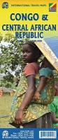
This is a really exciting map, in that an area as large as Europe has been added to ITMB’s Africa series. We have been working on this artwork for over three years. It covers all of the Democratic Republic of Congo (the former Congo-Kinshasa, or Zaire), all of the People’s Republic of the Congo (known as Congo-Brazzaville or French Congo), and the Central African Republic to the north. This is in reality a map of the vast rain forest known as the Congo River Basin, and matches our equally complicated map of the Amazon River Basin and the Mekong, Mississippi/Missouri, Nile, and Mackenzie maps that we have published previously. A word of warning: the road network in the Congo is primitive - that means largely non-existent or in such poor condition as to wreck army trucks. We show the roads, and tried to classify them by quality, but this is a ?work in progress’ and I hope that this map will create sufficient feedback to improve this aspect of the map. For this edition, we have laid the ground work for developing more detailed sectional maps as the need arises.

Kartenausschnitt

Kartenbeispiel

Demokratische Republik Kongo - Republik Kongo - Zentralafrikanische Republik 1:1.5 Mio. Landkarte - ITMB International Travel Maps
Congo/Democratic Republic of Congo & Central African Republic
EAN / ISBN: 9781771291910
Preis: EUR 12.90

sofort versandfertig Dieser Artikel ist im Normalfall sofort lieferbar.
Produkt EUR Anzahl Bestellen
Demokratische Republik Kongo - Republik Kongo - Zentralafrikanische Republik 1:1.5 Mio. Landkarte - ITMB International Travel Maps
Congo/Democratic Republic of Congo & Central African Republic
12.90
Versandkostenfrei in Deutschland ab 30,- Bestellwert

incl. MwSt.

Stichworte, die bei der Suche nützlich sein könnten:
Zentralafrika Landkarte - Congo - Kongo - Republik Kongo Landkarte - Congo Landkarte - Kongo-Kinshasa - Kongo-Kinshasa Landkarte - Zentralafrikanische Republik Landkarte - Kongo-Kinshasa Landkarte - Kongo Landkarte - ITMB - ITM - International Travel Maps - ITMB Internationale Landkarten - ITB-Karten - ITMB-Karten - International Travel Maps and Books - Französisch Kongo - Kongo Brazzaville - Kongo - Kongo Landkarten - Zaire - Demokratische Republik Kongo - Kongo Atlanten - Kongo Kartografie - Kongo Karten - Kongo Straßenkarten - Kongo Reiseführer - Kongo Landkartenverkauf - Kongo Kartographie - Kongokarten - Kongo Wanderkarten - Zentralafrika - République Centrafricaine - Republik Zentralafrika

Zuletzt angesehene Artikel:

CoverDemokratische Republik Kongo - Republik Kongo - Zentralafrikanische Republik 1:1.5 Mio. Landkarte - ITMB International Travel Maps
Congo/Democratic Republic of Congo & Central African Republic

CoverParc Nacional d`Aigüestortes i Estany de Sant Maurici 1:25.000 Mappe mit 2 Wanderkarten der Pyrenäen - Spanien - ALPINA

CoverHonduras 1:750.000 Landkarte - ITMB International Travel Maps (engl.)

CoverDithmarschen - Büsum - Heide Topographische Wanderkarte mit Wanderwegen und Radwegen 1:40.000 Schleswig-Holstein - ProjektNord

Cover224 Corby - Kettering & Wellingborough - Wanderkarte Großbritannien 1:25.000 EXPLORER MAP - Ordnance Survey

CoverL´Europe en Camping-car (aktuelle Jahresausgabe) Campingführer - Michelin

Cover1641 Born am Darß Amtliche Topographische Karte 1:25.000 Landesvermessungsamt Mecklenburg-Vorpommern

Cover207 Newport Pagnell & Northampton South - Wanderkarte Großbritannien 1:25.000 EXPLORER MAP - Ordnance Survey

Cover281 Ancholme Valley - Wanderkarte Großbritannien 1:25.000 EXPLORER MAP - Ordnance Survey

Noch kein Cover vorhanden2911SB Attigny - Sault-Les-Rethel GPS Amtliche Topographische Wanderkarte Frankreich 1:25.000 - série bleue (IGN)

CoverThorn plus 4 Stadtplan 1:18.000 (Strasburg, Kulmsee)
Torun plus 4 (Brodnica, Chelmza, Ciechocinek, Inowroclaw) - DEMART - Polen

CoverUkraine - Weißrussland - Moldawien Straßenkarte 1:2 Mio.
Ukraine - Moldova - Belorussia - Cartographia

CoverTM05 Eldon 1:50.000 Topographische Landkarte Tasmanien - Australien - Tasmap (Tasmanien)

Cover256 DISENTIS / MUSTÉR 1:50.000 - Oberalppass - Val Medel - Val Sumvitg - Topographische Landeskarte der Schweiz - swisstopo

Cover2238SB Figeac - Cajarc - GPS Amtliche Topographische Wanderkarte Frankreich 1:25.000 - série bleue (IGN)

Cover1444 Vitte (Hiddensee) Amtliche Topographische Karte 1:25.000 Landesvermessungsamt Mecklenburg-Vorpommern

Noch kein Cover vorhandenN-33-142-C/D Koscian Amtliche topographische Landkarte Polen 1:50.000
N-33-142-C/D Koscian - Mapa Topograficzna Polski Glowny Geodeta Kraju