(Titelbild evtl. abweichend)
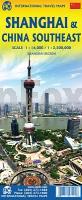 Altauflage 2009, daher zum Sonderpreis. Stadtplan des inneren Stadtbereiches von Shanghai. Mit Straßenverzeichnis, kleiner Umgebungskarte Shanghai und U-Bahn-Netzplan. Die Rückseite enthält eine Straßenkarte von Süd-Ost China 1:2.5 Mio. mit Ortsverzeichnis. Wasser- und reißfeste Karte.  Klicken Sie hier, wenn Sie diesen Artikel in der Version zum normalen Preis sehen möchten. Klicken Sie hier, wenn Sie diesen Artikel in der Version zum normalen Preis sehen möchten.
Kartenausschnitt
Kartenbeispiel
|
Shanghai und China Süd-Ost 1:16.000 / 1:2.5 Mio. *** SCHNÄPPCHEN *** Stadtplan - ITMB International Travel Maps
EAN / ISBN: 9781771297202
Preis: EUR 5.00
|
| 


