(Titelbild evtl. abweichend)
 Altauflage, daher zum Sonderpreis. Wanderkarte mit eingezeichneten Wanderwegen. Das Begleitheft enthält kurze Texte über die Streckenführung. Alle Texte auf italienisch.  Blattschnitt Abruzzen / L´Aquila Blattschnitt Abruzzen / L´Aquila
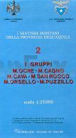
Kartenbeispiel Klicken Sie hier, wenn Sie diesen Artikel in der Version zum normalen Preis sehen möchten. Kartenausschnitt
|
2 I Gruppi Ocre - Cagno - Cava - San Rocco - Orsello - Puzzillo 1:25.000 *** SCHNÄPPCHEN *** Wanderkarte S.EL.CA - Club Alpino Italiano (CAI) - Italien (SELCA)
Preis: EUR 6.00
|
| 


