| << Norwegen: Küstenkarten Seekarten 1:200.000-1:350.000 sowie Oversejlingskart 1:700.000-1:10 Mio.- Statens Kartverk |
  | |
Zuletzt angesehene Artikel:
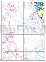
![]() | 306 Nordsjøen - Norwegen Küstenkarte 1:350.000 306 Kystkart Statens Kartverk Sjø - Norwegen |
![]() | 2250ET BOURG-MADAME - MONT-LOUIS Topographische Wanderkarte Frankreich 1:25.000 TOP 25 IGN - (GPS) |
![]() | 30 Owaka Topographische Landkarte Neuseeland 1:250.000 Land Information New Zealand |
![]() | Parc Naturel Régional Loire - Anjou - Tourraine 1:80.000 Nationalparke Frankreich - IGN |
![]() | 3132SB BOURGOIN-JALLIEU - LA VERPILLIERE GPS Amtliche Topographische Wanderkarte Frankreich 1:25.000 - série bleue (IGN) |
![]() | 3027SB TOURNUS - LUGNY GPS Amtliche Topographische Wanderkarte Frankreich 1:25.000 - série bleue (IGN) |
![]() | 1633SB Barbezieux-Saint-Hilaire - Baignes-Sainte-Radegonde - GPS Amtliche Topographische Wanderkarte Frankreich 1:25.000 - série bleue (IGN) |
![]() | 39 NIVELLES - NIJVEL NGI 1:50.000 Topographische Karte Belgien |
![]() | LOIR-ET-CHER - BLOIS - VENDÔME - ROMORANTIN - SOLOGNE (Blatt D41) Département-Landkarte Frankreich 1:100.000 LOIR-ET-CHER - Carte départementale - IGN Frankreich |
![]() | 312.4 Amtliche topographische Karte 1:50.000 Polen |
![]() | 330 Moffat & St Mary`s Loch - Wanderkarte Großbritannien 1:25.000 EXPLORER MAP - Ordnance Survey |
![]() | 350 Edinburgh - Musselburgh und Queensferry - Wanderkarte Großbritannien 1:25.000 EXPLORER MAP - Ordnance Survey |
![]() | 3041OT AVIGNON Topographische Wanderkarte Frankreich 1:25.000 TOP 25 IGN - (GPS) |
![]() | 37 Lidköping 1:50.000 (wasserfest) Topographische Wanderkarte - Sverigeserien Topo50 - Schweden Kartförlaget |
![]() | 35-559 Eifelwandern 9 Hohe Eifel (Nord) - Ahrgebirge 1:25.000 - Adenau, Altenahr, Arft, Dernau, Effelsberg, Insul, Mayschoß - Wanderkarte mit Radwegen - NaturNavi |
![]() | 30 Wanderungen Pfälzerwald und Deutsche Weinstraße - OutdoorHandbuch (Band 354) - Regional - von Jürgen Plogmann Conrad-Stein-Verlag |
![]() | 1436SB SAINT-MEDARD-EN-JALLES - CASTELNAU-DE-MEDOC GPS Amtliche Topographische Wanderkarte Frankreich 1:25.000 - série bleue (IGN) |
![]() | Schweden 1:750.000 Doppelkarte Nord + Süd - Kümmerly & Frey |
![]() | 3338OT SERRES-VEYNES Topographische Wanderkarte Frankreich 1:25.000 TOP 25 IGN - (GPS) |
![]() | 1446ET TARDETS-SORHOLUS Topographische Wanderkarte Frankreich 1:25.000 *** SCHNÄPPCHEN *** TOP 25 IGN - (GPS) |


