| << Norwegen: Seekarten Norwegische Küste 1:50.000 - Statens Kartverk |
  | |
|
||
Zuletzt angesehene Artikel:
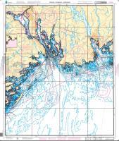
![]() | Svenner - Porsgrunn - Jomfruland - Seekarte Norwegische Küste 1:50.000 - (Blatt 5) Den Norske Kyst 005 Sjøkart - Hovedkart (sjø) Statens Kartverk Sjø - Norwegen |
![]() | Q532 Lauvuskylä Topographische Karte 1:50.000 EUREF-FIN (Maastokarttat) Maanmittauslaitos / Lantmäteriverket Finnland - ProjektNord |
![]() | Woiwodschaft Lebus - Administrativ-touristische Landkarte 1:200.000 (Blatt 482) WOJEWÓDZTWO LUBUSKIE mapa administracyjno-turystyczna Cartomedia - Sygnatura Polen |
![]() | 2328 Trittau - Gestern und Heute - Historische Überlagerung 1902-1930 Topographische Landkarte 1:25.000 im Vergleich - Landesvermessungsamt Schleswig-Holstein / ProjektNord |
![]() | 1729 Lütjenburg - Gestern und Heute - Historische Überlagerung 1932-1950 Topographische Landkarte 1:25.000 im Vergleich - Landesvermessungsamt Schleswig-Holstein / ProjektNord |
![]() | 5059 Altkemnitz Topographische Karte 1:25.000 Messtischblatt des Deutschen Reiches - Preußische Landesaufnahme / Reichsamt für Landesaufnahme - Faksimile ProjektNord |
![]() | 276 Topographische Landkarte Wanderkarte und Fahrradkarte Portugal 1:25.000 276 Mapa topográfico - Mapa de caminhadas - Portugal 1:25.000 ProjektNord |
![]() | 012 Hohe Wand - Piestingtal - Triestingtal - Gölsental - Gutensteiner Alpen - Lilienfeld 1:50.000 - Wanderkarte / Radwanderkarte / Wintersportkarte Österreich - GPS - Freytag & Berndt |
![]() | 425-1 CUBO DE TIERRA DEL VINO Amtliche topographische Landkarte 1:25.000 Spanien (M.T.N.) 425-1 Mapa Topográfico Nacional de Espana (MTN25) Instituto Geográfico Nacional - CNIG Spanien |
![]() | 0941-4 SIERRA DE LA CRUZ Topographische Landkarte 1:25.000 Spanien (Grundlage MTN25) Instituto Geográfico Nacional - CNIG Spanien - ProjektNord |
![]() | 4168 Gostyn Topographische Karte 1:25.000 Messtischblatt des Deutschen Reiches - Preußische Landesaufnahme / Reichsamt für Landesaufnahme - Faksimile ProjektNord |
![]() | 879 Peñarroya-Pueblo Nuevo Amtliche topographische Landkarte 1:50.000 Spanien (M.T.N.) 879 Mapa Topográfico Nacional de Espana (MTN50) Instituto Geográfico Nacional - CNIG Spanien |
![]() | Q514 Maanselkä Topographische Karte 1:50.000 EUREF-FIN (Maastokarttat) Maanmittauslaitos / Lantmäteriverket Finnland - ProjektNord |
![]() | M-34-37-A/B Kluczbork Amtliche topographische Landkarte Polen 1:50.000 M-34-37-A/B Kluczbork - Mapa Topograficzna Polski Glowny Geodeta Kraju |
![]() | 118 Loben - Karte des Deutschen Reiches 1:100.000 (KDR 100 GB) - Großblatt Reichsamt für Landesaufnahme / Preußische Landesaufnahme ProjektNord |
![]() | 0535-4 AZUQUECA DE HENARES Topographische Landkarte 1:25.000 Spanien (Grundlage MTN25) Instituto Geográfico Nacional - CNIG Spanien - ProjektNord |
![]() | 944-1 ATALAYUELA Amtliche topographische Landkarte 1:25.000 Spanien (M.T.N.) 944-1 Mapa Topográfico Nacional de Espana (MTN25) Instituto Geográfico Nacional - CNIG Spanien |
![]() | 335 Castelo de Vide Topographische Landkarte Wanderkarte und Fahrradkarte Portugal 1:25.000 335 Mapa topográfico - Mapa de caminhadas - Portugal 1:25.000 ProjektNord |
![]() | 154 Topographische Landkarte Wanderkarte und Fahrradkarte Portugal 1:25.000 154 Mapa topográfico - Mapa de caminhadas - Portugal 1:25.000 ProjektNord |
![]() | 1107-III El Tablero - Gran Canaria Amtliche topographische Landkarte 1:25.000 Spanien (M.T.N.) 1107-III Mapa Topográfico Nacional de Espana (MTN25) Instituto Geográfico Nacional - CNIG Spanien |


