| << Cookinseln - Tokelau-Inseln - Niue - Kermadecinseln |
||
|
||
Zuletzt angesehene Artikel:
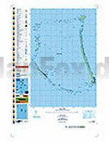
 | PI02 Nukunonu (Tokelau-Inseln) Topographische Landkarte 1:25.000 - Land Information New Zealand |
 | Berlin RadLandLust 32 Lieblingstouren - E-Bike-geeignet mit Knotenpunkte und Wohnmobilstellplätze - BVA BikeMedia |
 | DuMont Reise-Taschenbuch Réunion von Eiletz-Kaube, Daniela u. Kaube, Kurt |
 | 3741-SO Topographische Karte 1:10.000 - Landesvermessungsamt Brandenburg |
 | 103 Isergebirge Fahrradkarte Tschechien 1:60.000 Jizerské hory - SHOCart |
 | 291 Goole & Gilberdyke - Wanderkarte Großbritannien 1:25.000 EXPLORER MAP - Ordnance Survey |