| << Cookinseln - Tokelau-Inseln - Niue - Kermadecinseln |
||
|
||
Zuletzt angesehene Artikel:
 | PI05 Pukapuka (Cookinseln) Topographische Landkarte 1:25.000 - Land Information New Zealand |
 | Portugals Rota Vicentina - Alentejo and Algarve coastal route Wanderführer - Cicerone - Gillian Price( englisch) |
 | Chamonix & the Mont Blanc region Trail Running Laufführer (englisch) Cicerone GroÃbritannien |
 | 105K01 - Tenas Creek Topographische Landkarte 1:50.000 - Canada - Yukon |
 | Kalifornien 1:800.000 StraÃenkarte USA - IGN |
 | 217 Skiathos 1:15.000 Landkarte Griechische Inseln - Road Editions - Griechenland |
 | Schneeschuhwandern Ausrüstung - Planung -· Technik - von Andreas Happe - Conrad-Stein-Verlag |
 | La Gomera 73 Touren - Die schönsten Küsten- und Bergwanderungen GPS - Rother Wanderführer - Bergverlag Rother |
 | MARCO POLO Karten 1:200.000 Belgien / Luxemburg |
 | 118 Viechtach 1:35.000 Wanderkarte Fritsch Landkarten-Verlag |
| 105G02 - Fire Lake Topographische Landkarte 1:50.000 - Canada - Yukon |
| Fort Lauderdale City-Stadtplan laminiert (Florida - USA) Fort Lauderdale city map laminated |
| 015 S Iddefjorden SÃR 1:50.000 - Amtliche Topographische Landkarte Norwegen - Startens Kartverk |
 | Esperanto - Wort für Wort Kauderwelsch-Sprachführer (Band 056) Reise-Know-How Verlag |
 | Røldal & Haukeli 1:50.000 Turkart - Wanderkarte Norwegen - Calazo Förlag |
 | 305 Zakynthos 1:50.000 Landkarte Griechische Inseln - Road Editions - Griechenland |
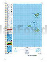
 | Königreich Tonga Landkarte - ITMB International Travel Maps (engl.) Tonga Islands |
 | Jauer - Bolkenhain - Stadtplan 1:9.000 Jawor, Bolków PLAN Galileos - Polen |
 | 438 Tabor Wanderkarte Tschechien 1:40.000 - SHOCart Táborsko - SHOCart |
 | Bangladesh - Reiseführer - Petit Futé Country Guides (franz.) |