| << Cookinseln - Tokelau-Inseln - Niue - Kermadecinseln |
||
|
||
Zuletzt angesehene Artikel:
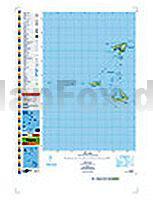
 | PI05 Pukapuka (Cookinseln) Topographische Landkarte 1:25.000 - Land Information New Zealand |
 | Kenia Landkarte (Blatt 3205) AdventureMap wasserfest Kenya National Geographic |
 | 9: Nevado Ojos del Salado 1:100.000 Trekkingkarte - Andes-handbook - Chile |
 | Nordkinnhalvøya 1:60.000 Wanderkarte - Turkart Norwegen - Calazo Förlag |
 | Italien Mitte (Blatt 2) StraÃenkarte 1:400.000 Italia centrale - Carta stradale e turistica Touring-Club Italiano (TCI) Italien |
 | Rheinsberger Seengebiet - Ruppiner Land 1:50.000 (Blatt 743) - Wanderkarte mit Broschüre KOMPASS |
 | Slavyanka 1:25.000 Topographische Wanderkarte - Bulgarien Iskartour Bulgarien |
 | Cotopaxi 1:40.000 Trekkingkarte Ecuador Climbing and Trekking Map |
 | AREA 2: San Pedro de Atacama - Regionale Landkarte 1:400.000 2 Mapa TurÃstico: San Pedro de Atacama Mapas Compass Chile |
 | 14 Saarer Höhe - Touristische Landkarte Tschechien 1:100.000 Zdárské vrchy - Turistická mapa KARTOGRAFIE PRAHA |
 | 425 Huntly & Cullen - Wanderkarte GroÃbritannien 1:25.000 EXPLORER MAP - Active Map LAMINIERT - Ordnance Survey |
 | 32 Jungfrauregion MTB-Karte 1:50.000 Grindelwald - Interlaken - Meiringen - Swiss Singletrail Map |
 | 432.14 Amtliche topographische Karte 1:25.000 Polen |
| CC 8726 Kempten (Allgäu) Bodenübersichtskarte 1:200.000 - Bundesanstalt für Geowissenschaften und Rohstoffe (BGR) |
| 365.42 Amtliche topographische Karte 1:25.000 Polen |
 | 4 Lausitzer Gebirge Wanderkarte Tschechien 1:50.000 Luzické hory - SHOCart |
| 136.11 Amtliche topographische Karte 1:25.000 Polen |
 | 3642ET VALLEE DE L`ESTERON Topographische Wanderkarte Frankreich 1:25.000 TOP 25 IGN |
 | Porto - Stadtplan 1:15.000 - City Pocket + The Big Five - Freytag-Berndt und ARTARIA |
| 212.42 Amtliche topographische Karte 1:25.000 Polen |