| << Cookinseln - Tokelau-Inseln - Niue - Kermadecinseln |
||
|
||
Zuletzt angesehene Artikel:
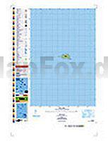
 | PI14 Takutea (Cookinseln) Topographische Landkarte 1:25.000 - Land Information New Zealand |
 | Sunnfjord - Jølster - Førde 1:50.000 Wanderkarte - Turkart Norwegen - Calazo Förlag |
 | Var per Fahrrad Fahrradkarte 1:110.000 Le Var à velo IGN Frankreich |
 | Rauhelleren Wanderkarte Norwegen 1:50.000 (Blatt 2727) - Nordeca / UGLAND / Statens Kartverk Norwegen |
 | Eure - Seine-Maritime Straßenkarte Local 1:150.000 (Blatt 304) Michelin Frankreich |
 | 206 Edge Hill & Fenny Compton - Wanderkarte Großbritannien 1:25.000 EXPLORER MAP - Active Map LAMINIERT - Ordnance Survey |
 | CD16 Topographische Landkarte Neuseeland 1:50.000 Land Information New Zealand |