| << Cookinseln - Tokelau-Inseln - Niue - Kermadecinseln |
||
|
||
Zuletzt angesehene Artikel:
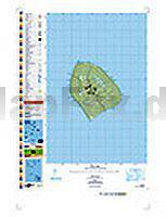
 | PI15 Atiu (Cookinseln) Topographische Landkarte 1:25.000 - Land Information New Zealand |
 | Braunschweig 1948 (Trümmerplan-Nachdruck) (Blatt 1) Bildstadtplan Bollmann-Bildkarten-Verlag |
 | St. Pölten Stadtplan + Bezirkskarte. 1:15.000 - freytag & berndt |
 | 357 Kintyre North - Wanderkarte GroÃbritannien 1:25.000 EXPLORER MAP - Ordnance Survey |
 | Reisegast in Ãgypten Iwanowski´s Reisebuchverlag |
 | Rostock- Güstrow wasserfest Fahrradkarte 1:75.000 - Grünes Herz |
 | Walk in the Clouds 50 years among the mountains Wanderführer - Cicerone (englisch) |
 | Niederlande 1:250.000 StraÃenkarte PLANO Falk |
 | DUMONT Reise-Taschenbuch La Gomera von Lipps, Susanne u. Breda, Oliver |
 | Casentino 1:50.000 Wanderkarte S.EL.CA - Italien (SELCA) |
 | Loire - 60 plus beaux sentiers à pied Wanderführer - (französisch) Chamina - Frankreich |
 | Taiwanisch - Wort für Wort Kauderwelsch-Sprachführer (Band 170) Taiwan - Reise-Know-How Verlag |
 | Katalonien StraÃenkarte Spanien 1:300.000 Catalogne IGN |
 | Küstengeheimnisse (Band 3) Italienische Adriaküste - Süd - von Günter Lengnink - virtualStore |
 | Umgebung von Paris StraÃenkarte Zoom 1:100.000 (Blatt 106) Michelin |
 | Autour de Vendôme à pied - Centre-Val de Loire Wanderführer - (französisch) Chamina - Frankreich |
 | Nièvre 30 balades à pied Wanderführer - (französisch) Chamina - Frankreich |
 | DuMont direkt Lago Maggiore *** SCHNÃPPCHEN *** von Lonmon, Aylie |
 | Dubai / UAE / Oman 1:15.000 - 1:950.000 *** SCHNÃPPCHEN *** - ITMB International Travel Reference Map |
 | Yorkshire Dales - Sedbergh, Kirkby Lonsdale and Ingleton 15 short walks Wanderführer - Cicerone GroÃbritannien (englisch) |