| << Cookinseln - Tokelau-Inseln - Niue - Kermadecinseln |
||
|
||
Zuletzt angesehene Artikel:
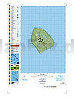
 | PI15 Atiu (Cookinseln) Topographische Landkarte 1:25.000 - Land Information New Zealand |
 | 3136ET COMBE-LAVAL/FORET DE LENTE Topographische Wanderkarte Frankreich 1:25.000 TOP 25 IGN - (GPS) |
 | Republik Usbekistan - Landkarte 1:1.5 Mio. Respublika Uzbekistan |
 | Lomza-Landschaftspark Narew-Tal 1:50.000 - Touristische Landkarte und Wanderkarte Polen Lomzynski Park Krajobrazowy Doliny Narwi - Lomza Landscape Park of the Narew River Valley Pracownia Map i Wydawnictw Turystycznych MH Miroslaw Haba |
 | Celle 1994 (Blatt 276) Historischer Bildstadtplan Bollmann-Bildkarten-Verlag |
 | Flussfahren in Frankreich FRANCE TOURISME FLUVIAL 1:1 Mio - IGN - Frankreich |
 | Alto Lario Occidentale - Wanderkarte 1:25.000 mit Skitouren Ingenia Editori - Italien |
| 2523SB la Charité-sur-Loire - Suilly-la-Tour GPS Amtliche Topographische Wanderkarte Frankreich 1:25.000 - série bleue (IGN) |
 | MILLEVACHES EN LIMOUSIN 1:100.000 *** SCHNÄPPCHEN *** Kultur und Natur - IGN Frankreich |
 | England Südost 1:400.000 Straßenkarte Großbritannien (Blatt 504) England South East Michelin Regional |
 | Sao Paulo 1:12.500 - Südküste Brasiliens 1:1.2 Mio. Stadtplan - ITMB International Travel Maps São Paulo & Brasil South Coast |
| 2512OT VILLERS-COTTERETS Topographische Wanderkarte Frankreich 1:25.000 TOP 25 IGN - (GPS) |
| 2324SB Bourges / Mehun-sur-Yèvre GPS Amtliche Topographische Wanderkarte Frankreich 1:25.000 - série bleue (IGN) |
 | LOZERE (Blatt D48) Département-Landkarte Frankreich 1:100.000 LOZÈRE - Carte départementale - IGN Frankreich |
| 2: Sierra de Ramón Trekkingkarte - Andes-handbook - Chile |
 | 1109 SCHÖFTLAND 1:25.000 - Zofingen - Triengen - Unterkulm - Topographische Landeskarte der Schweiz - swisstopo |
 | CT8 Redange / Attert 1:20.000 Topographische Karte - Luxemburg |
 | 1221 Handewitt Topographische Landkarte 1:25.000 Landesvermessungsamt Schleswig-Holstein |
 | Sardinien Reiseführer Michael-Müller-Verlag - Reiseführer |
 | Riesengebirge - Isergebirge 1:50.000 Touristische Wanderkarte, Fahrradkarte, Radwanderkarte -Polen Karkonosze - Góry Izerskie Galileos / PLAN |