| << Cookinseln - Tokelau-Inseln - Niue - Kermadecinseln |
||
|
||
Zuletzt angesehene Artikel:
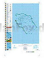
 | PI16 Penrhyn (Cookinseln) Topographische Landkarte 1:50.000 - Land Information New Zealand |
 | Costa Daurada - Katalonien Süd: Barcelona bis Naturpark dels Ports - Wanderführer 50 Touren - Bergverlag Rother |
 | Nordseeküsten-Radweg 1: Rotterdam - Leer 1:75.000 bikeline Radwanderführer - Esterbauer |
 | Harz 1:50.000 - Wanderkarten-Set mit Naturführer (Nr. 450) Mit Radrouten - KOMPASS |
 | 1337ET BASSIN D`ARCACHON Topographische Wanderkarte Frankreich 1:25.000 TOP 25 IGN |
 | 141 Cerova vrchovina - Lucenec Wanderkarte Slowakei 1:50.000 - VKU |
 | Zittauer Gebirge - Ãstlicher Teil Wanderkarte 1:10.000 - Rolf Böhm Verlag |
 | 1947OT ASPET - PIC DE MAUBERMÃ Topographische Wanderkarte Frankreich 1:25.000 TOP 25 IGN - (GPS) |
 | 05 Ballycastle - Wanderkarte Nord-Irland 1:50.000 DISCOVERER MAP - Ordnance Survey |
 | Die Larve Kriminalroman. Harry Holes neunter Fall - von Jo Nesboe - Ullstein HC |
 | 2036ET SARLAT / SOUILLAC Topographische Wanderkarte Frankreich 1:25.000 TOP 25 IGN - (GPS) |
| Madsion County County-StraÃenkarte 1:63.000 (Ohio - USA) Madsion County county map GIS / Cartography & Publishing Services / GM Johnson |
 | Comer See - Trekking map 1:50.000 - Laminierte Landkarte Lake Como / Lago di Como terraQuest ExpressMap |
 | Pfälzerwald 2 Topographische Wanderkarte Rheinland-Pfalz mit Wanderwegen und Radwegen 1:25.000 - ProjektNord |
 | Hocharabisch - Wort für Wort Kauderwelsch-Sprachführer (Band 76) Reise-Know-How Verlag |
 | 137 Ashford - Headcorn - Chilham & Wye - Wanderkarte GroÃbritannien 1:25.000 EXPLORER MAP - Active Map LAMINIERT - Ordnance Survey |
 | 6809 Gersheim Topographische Karte 1:25.000 - Landesvermessungsamt Saarland |
 | MARCO POLO Citymap Strassburg / Strasbourg 1:15.000 MairDuMont |
 | Schutzpatron Kluftingers neuer Fall - von Volker Klüpfel, Michael Kobr - Piper |
 | PI06 Nassau (Cookinseln) Topographische Landkarte 1:25.000 - Land Information New Zealand |