| << Cookinseln - Tokelau-Inseln - Niue - Kermadecinseln |
||
|
||
Zuletzt angesehene Artikel:
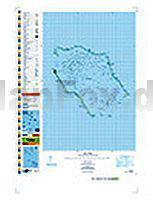
 | PI16 Penrhyn (Cookinseln) Topographische Landkarte 1:50.000 - Land Information New Zealand |
 | Berdjansk Stadtplan 1:19.000 Berdians`k Kartografija - ukrmap Ukraine |
 | 484.24 Pilchowice Amtliche topographische Karte 1:25.000 Polen |
 | MARCO POLO Länderkarte Montenegro 1:250.000 MAIRDUMONT |
| 105O - Niddery Lake Topographische Landkarte 1:250.000 - Canada - Yukon |
 | Erlebnisregion Edersee 1:50.000 - laminiert - wetterfest Wanderkarte + Radwanderkarte Nordhessen KKV - Kartographische Kommunale Verlagsgesellschaft |
| 1583 Neukrug Topographische Karte 1:25.000 Messtischblatt des Deutschen Reiches - Preußische Landesaufnahme / Reichsamt für Landesaufnahme - Faksimile ProjektNord |
| 1322 Tarp - Gestern und Heute - Historische Überlagerung 1953-1956 Topographische Landkarte 1:25.000 im Vergleich - Landesvermessungsamt Schleswig-Holstein / ProjektNord |