| << Cookinseln - Tokelau-Inseln - Niue - Kermadecinseln |
||
|
||
Zuletzt angesehene Artikel:
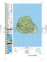
 | PI17 Mangaia (Cookinseln) Topographische Landkarte 1:25.000 - Land Information New Zealand |
 | Republik Aserbaidschan Topographische Straßenkarte 1:500.000 Azerbaycan Respublikasi - Avtomobil Yollari Baki Kartoqrafiya Fabriki BKF - Baku Aserbaidschan |
 | M-34-67-C/D Debica Amtliche topographische Landkarte Polen 1:50.000 M-34-67-C/D Debica - Mapa Topograficzna Polski Glowny Geodeta Kraju |
 | 19/3-4 DE MOEREN - VEURNE NGI 1:25.000 Topographische Landkarte Belgien |
 | Kronobergs län Terräng CD (3) Topographische Landkarte Schweden 1:50.000 auf CD-ROM Kartförlaget Schweden |
 | Kanada - der Westen Reiseführer Michael-Müller-Verlag - Reiseführer |
 | Nordamerika physisch-politisch 1:8 Mio. Wandkarte metallbestäbt in Rolle freytag & berndt |
| Nuuksion järviylänkö, geologinen kartta 1:25.000 Geologische Landkarte Finnland |
 | Albanien `Albania on the road` Straßenkarte 1:350.000 (Blatt 1201) Albania - Shqipëria Vektor Editions - Albanien |
 | 05 Bardaströnd Atlaskort - Topographische Landkarte Island 1:100.000 Barðaströnd Forlagid - Mál og menning - Island |
 | 1843 Franzburg Amtliche Topographische Karte 1:25.000 Landesvermessungsamt Mecklenburg-Vorpommern |
 | Fokida (Blatt 190) Präfektur Landkarte 1:150.000 Φωκίδα Orama - Griechenland |
 | 1095 Chocgebirge Wanderkarte Slowakei 1:50.000 Chocske vrchy SHOCart |
 | 2850 Passow Topographische Karte 1:25.000 Landesvermessungsamt Brandenburg (gefaltet) |
 | 7223 Göppingen Topographische Landkarte 1:25.000 - Landesvermessungsamt Baden-Württemberg |
 | Rund um Braunschweig 5 - Elm Topographische Wanderkarte mit Wanderwegen und Radwegen 1:25.000 Niedersachsen - ProjektNord |
 | 020 Prealpi del Gemonese - Colli morenici del Friuli Topographische Wanderkarte 1:25.000 - Casa Editrice Tabacco - Italien |
 | 17 Nyjabaejarfjall Atlaskort - Topographische Landkarte Island 1:100.000 Nýjabæjarfjall Forlagid - Mál og menning - Island |
| L7918 Spaichingen Topographische Landkarte 1:50.000 - Landesvermessungsamt Baden-Württemberg |
| M-34-30-A/B Szydlowiec Amtliche topographische Landkarte Polen 1:50.000 M-34-30-A/B Szydlowiec - Mapa Topograficzna Polski Glowny Geodeta Kraju |