| << Österreich: Topographische Wanderkarten 1:50.000 - ProjektNord << Novitäten von ProjektNord |
  | |
|
||
Zuletzt angesehene Artikel:
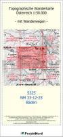
![]() | 5325 (NM 33-12-25) Baden Topographische Wanderkarte 1:50.000 mit Wegmarkierungen - Österreich - Kartographie BEV - ProjektNord |
![]() | 5703 Bleialf Topographische Karte 1:25.000 - Landesamt für Vermessung und Geobasisinformation Rheinland-Pfalz |
![]() | 2851-SO Topographische Karte 1:10.000 - Landesvermessungsamt Brandenburg |
![]() | 5414 Mengerskirchen Topographische Landkarte Hessen 1:25.000 - ProjektNord (geplottete Ausgabe) |
![]() | 232 Muranska Planina - Slovenske Rudohorie zapad Touristische Landkarte Slowakei 1:100.000 Muranska Plania - Slovenske Rudohorie zapad - SHOCart |
![]() | 52 Schwarzwald - Pforzheim - 1:35.000 Outdoorkarte - Wanderkarte Kümmerly & Frey |
![]() | 214/225 Pokrovs`ke / Polohy - Amtliche topographische Landkarte 1:100.000 der Ukraine Kiewskaja Wojenno-Kartografitscheskaja Fabrika Ukraine |
![]() | 286 Blackpool & Preston - Lytham St Anne`s & Leyland - Wanderkarte Großbritannien 1:25.000 EXPLORER MAP - Ordnance Survey |
![]() | 50 Wanderrouten im Peak District Wanderführer - AA Automobile Association / OS Ordnance Survey - Großbritannien 50 walks in the Peak District - walking guide |
![]() | 22-c Topographische Landkarte Georgien 1:50.000 Geoland Maps Georgien |
![]() | 243.31 Amtliche topographische Karte 1:25.000 Polen |
![]() | 2719 Worpswede Amtliche topographische Karte 1:25.000 Landesvermessungsamt Niedersachsen |
![]() | 2679 Rehden Topographische Karte 1:25.000 Messtischblatt des Deutschen Reiches - Preußische Landesaufnahme / Reichsamt für Landesaufnahme - Faksimile ProjektNord |
![]() | 50 Walks in North-Yorkshire Wanderführer - AA Automobile Association / OS Ordnance Survey - Großbritannien |
![]() | 592 Bordeira (Aljezur) Topographische Landkarte Wanderkarte und Fahrradkarte Portugal 1:25.000 592 Mapa topográfico - Mapa de caminhadas - Portugal 1:25.000 ProjektNord |
![]() | 50 Wanderrouten in den Yorkshire Dales Wanderführer - AA Automobile Association / OS Ordnance Survey - Großbritannien 50 walks in the Yorkshire Dales - walking guide |
![]() | 524 Topographische Landkarte Wanderkarte und Fahrradkarte Portugal 1:25.000 524 Mapa topográfico - Mapa de caminhadas - Portugal 1:25.000 ProjektNord |
![]() | 5931 Ebensfeld Topographische Landkarte Bayern 1:25.000 - Normalausgabe - ProjektNord (geplottete Ausgabe) - Grundlage amtliche Topographische Karte Bayern DTK25 |
![]() | 2915SB Vitry-le-François - Sompuis GPS Amtliche Topographische Wanderkarte Frankreich 1:25.000 - série bleue (IGN) |


