| << Russland: Städte, Stadtpläne, Stadtatlanten, Stadtführer << Russland: Oblaste und Regionen etc. << Rus Co. Ltd. |
||
|
||
Zuletzt angesehene Artikel:
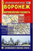
 | Woronesch - Oblast Woronesch Stadtatlas und Straßenatlas 1:20.000 / 1:750.000 Voronesch - Voroneschskaja Oblast Rus Co. Ltd. - Russland |
 | 1092 PUERTO DE LA CRUZ Topographische Landkarte 1:50.000 Spanien (Grundlage MTN50) Instituto Geográfico Nacional - CNIG Spanien - ProjektNord |
 | Hersbrucker Schweiz (Blatt 4) Wanderkarte 1:35.000, Wanderwege, Radwege, Wassersport, Freizeiteinrichtungen, Sehenswürdigkeiten, Übersichtkarte Appelt-Verlag |
 | 557-1 CEBREROS Amtliche topographische Landkarte 1:25.000 Spanien (M.T.N.) 557-1 Mapa Topográfico Nacional de Espana (MTN25) Instituto Geográfico Nacional - CNIG Spanien |
 | Q5222 Manamansalo Topographische Karte 1:25.000 EUREF (Peruskartta) Maanmittauslaitos / Lantmäteriverket Finnland - ProjektNord |
 | NL 32-06-06 (2106) Sand in Taufers Österreichische Karte 1:50.000 mit Wegmarkierungen (topographische Wanderkarte - UTM) - BEV - Österreich |
 | 571-3 STA. MAGDALENA DE PULPIS Amtliche topographische Landkarte 1:25.000 Spanien (M.T.N.) 571-3 Mapa Topográfico Nacional de Espana (MTN25) Instituto Geográfico Nacional - CNIG Spanien |
 | 44-2 (08-09) CAIÓN Amtliche topographische Landkarte 1:25.000 Spanien (M.T.N.) 44-2 Mapa Topográfico Nacional de Espana (MTN25) Instituto Geográfico Nacional - CNIG Spanien |
 | 4926 Herleshausen - Wanderkarte mit Wanderwegen (geplottete Ausgabe) Topographische Landkarte Hessen 1:25.000 - ProjektNord (geplottete Ausgabe) |
 | 1993 Heiligelinde Topographische Karte 1:25.000 Messtischblatt des Deutschen Reiches - Preußische Landesaufnahme / Reichsamt für Landesaufnahme - Faksimile ProjektNord |
 | 170 Vale of Glamorgan West/Gorllewin Bro Morgannwg - Rhondda & Porthcawl - Wanderkarte Großbritannien 1:50.000 Active Laminiert LANDRANGER MAP - Ordnance Survey |
| Beckley / Bluefield / Oak Hill, Princeton Stadtplan 1:36.000 (West Virginia - USA) Beckley / Bluefield / Oak Hill, Princeton street map GM Johnson |
 | 5116 Eibelshausen - Wanderkarte mit Wanderwegen (geplottete Ausgabe) Topographische Landkarte Hessen 1:25.000 - ProjektNord (geplottete Ausgabe) |
| 298-2 MARZÁN Amtliche topographische Landkarte 1:25.000 Spanien (M.T.N.) 298-2 Mapa Topográfico Nacional de Espana (MTN25) Instituto Geográfico Nacional - CNIG Spanien |
 | 3717 Kirchlengern (geplottete Ausgabe) Amtliche topographische Karte 1:25.000 Landesvermessungsamt Nordrhein-Westfalen |
| 2175 Occippel Topographische Karte 1:25.000 Messtischblatt des Deutschen Reiches - Preußische Landesaufnahme / Reichsamt für Landesaufnahme - Faksimile ProjektNord |
 | Costa Smeralda e Olbia - Sardinien 1:75.000 (Blatt B081) Touristische Wanderkarte Italien mit touristischer Begleitbroschüre - Belletti Editore |
 | 196-1 CALZADILLA DE LOS HERMANILLOS Amtliche topographische Landkarte 1:25.000 Spanien (M.T.N.) 196-1 Mapa Topográfico Nacional de Espana (MTN25) Instituto Geográfico Nacional - CNIG Spanien |
 | L4510 Dortmund (geplottete Ausgabe) Amtliche topographische Karte 1:50.000 Landesvermessungsamt Nordrhein-Westfalen |
 | 2213-IV-SØ Topographische Karte Dänemark 1:25.000 Topografisk kort Danmark (DTK/Kort25) 2213-IV-SØ ProjektNord - Kort & Matrikelstyrelsen / Geodætisk Institut |