| << Russland: Städte, Stadtpläne, Stadtatlanten, Stadtführer << Russland: Oblaste und Regionen etc. << Rus Co. Ltd. |
||
|
||
Zuletzt angesehene Artikel:
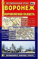
 | Woronesch - Oblast Woronesch Stadtatlas und StraÃenatlas 1:20.000 / 1:750.000 Voronesch - Voroneschskaja Oblast Rus Co. Ltd. - Russland |
 | 0160 BENAVIDES DE ÃRBIGO Topographische Landkarte 1:50.000 Spanien (Grundlage MTN50) Instituto Geográfico Nacional - CNIG Spanien - ProjektNord |
 | NM 33-11-21 Ost (4321-Ost) Grein Ãsterreichische Karte 1:25.000 mit Wegmarkierungen (topographische Wanderkarte - UTM) - BEV - Ãsterreich - VergröÃerung (ÃK25V) |
 | 5004 Jülich (geplottete Ausgabe) Amtliche topographische Karte 1:25.000 Landesvermessungsamt Nordrhein-Westfalen |
| 2961 Regenthin Topographische Karte 1:25.000 Messtischblatt des Deutschen Reiches - PreuÃische Landesaufnahme / Reichsamt für Landesaufnahme - Faksimile ProjektNord |
| 3163 Filehne Topographische Karte 1:25.000 Messtischblatt des Deutschen Reiches - PreuÃische Landesaufnahme / Reichsamt für Landesaufnahme - Faksimile ProjektNord |
 | Rhön Radkarte mit Ausflugszielen, Einkehr- & Freizeittipps, wetterfest, reissfest, abwischbar, GPS-genau. 1:100000 - von - Freytag-Berndt und ARTARIA PUBLICPRESS |
| Iwanowice Topographische Karte 1:25.000 Messtischblatt des Deutschen Reiches - PreuÃische Landesaufnahme / Reichsamt für Landesaufnahme - Faksimile ProjektNord |
 | Niederlande Nord StraÃenkarte 1:200.000 mit Register Nederland Noord - Weegenkaart - ANWB - Niederlande |
 | Oblast Belgorod 1:400.000 StraÃenkarte / Touristenkarte - Russland Карта автодорог Белгородской области и прилегающих территорий Russland |
 | 0690-1 PINAREJO Topographische Landkarte 1:25.000 Spanien (Grundlage MTN25) Instituto Geográfico Nacional - CNIG Spanien - ProjektNord |
| 1626 Kiel - Gestern und Heute - Historische Ãberlagerung 1902-1930 Topographische Landkarte 1:25.000 im Vergleich - Landesvermessungsamt Schleswig-Holstein / ProjektNord |
 | Hainichlandweg 1:35.000 Wanderkarte + Radwanderkarte Thüringen - reiÃ- und wetterfest - KKV - Kartographische Kommunale Verlagsgesellschaft |
| 1519 Simonsberg - Gestern und Heute - Historische Ãberlagerung 1953-1956 Topographische Landkarte 1:25.000 im Vergleich - Landesvermessungsamt Schleswig-Holstein / ProjektNord |
 | 0352-4 TABUENCA Topographische Landkarte 1:25.000 Spanien (Grundlage MTN25) Instituto Geográfico Nacional - CNIG Spanien - ProjektNord |
 | 065 Julische Alpen Ost - Bohinj - Triglav GPS Topographische Wanderkarte 1:25.000 Alpi Giulie Orientali - Bohinj - Triglav Casa Editrice Tabacco - Italien |
| 1217 Midlum (Föhr) - Gestern und Heute - Historische Ãberlagerung 1902-1930 Topographische Landkarte 1:25.000 im Vergleich - Landesvermessungsamt Schleswig-Holstein / ProjektNord |
 | 128 Riello Amtliche topographische Landkarte 1:50.000 Spanien (M.T.N.) 128 Mapa Topográfico Nacional de Espana (MTN50) Instituto Geográfico Nacional - CNIG Spanien |
 | 0729-1 CANALEJA Topographische Landkarte 1:25.000 Spanien (Grundlage MTN25) Instituto Geográfico Nacional - CNIG Spanien - ProjektNord |
| 1725 Westensee - Gestern und Heute - Historische Ãberlagerung 1932-1950 Topographische Landkarte 1:25.000 im Vergleich - Landesvermessungsamt Schleswig-Holstein / ProjektNord |