| << Russland: Städte, Stadtpläne, Stadtatlanten, Stadtführer << Russland: Oblaste und Regionen etc. << Rus Co. Ltd. |
||
|
||
Zuletzt angesehene Artikel:
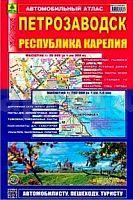
 | Petrosawodsk - Republik Karelien Stadtatlas und Straßenatlas 1:20.000 / 1:750.000 Petrozavodsk / Respublika Karelija Rus Co. Ltd. - Russland |
 | Druskininkai (55-59/15-19) Topografische Karte Litauen 1:50.000 Lietuvos Respublikos Topografinis Zemelapis 1:50.000 - Nacionaline Zemes Tarnyba - Litauen |
 | 1100-I (Fuerteventura) La Lajita Amtliche topographische Landkarte 1:25.000 Spanien (M.T.N.) 1100-I Mapa Topográfico Nacional de Espana (MTN25) Instituto Geográfico Nacional - CNIG Spanien |
 | Naturpark Saar-Hunsrück - Blatt West (SHW) 1:50.000 mit Saar-Hunsrück-Steig - den Traumschleifen Saar-Hunsrück und der Obermosel von Perl bis Trier Landkarte Mit Saar-Hunsrück-Steig und der Obermosel von Perl bis Trier. Mit Wander- und Radwanderwegen - Landesvermessungsamt Rheinland-Pfalz |
 | Lindesnes - Kolnesholmane / Tananger Serie 05 Bootsportkarten 1:50.000 Bootsportkarten 1:50.000 - Nordeca Norwegen 05 Lindesnes - Kolnesholmane / Tananger Båtsportkart |
 | ADAC Camping- / Stellplatzführer Italien - Kroatien - Österreich - Slowenien (aktuelle Jahresausgabe) Über 2.200 Camping- u. Stellplätze von ADAC Experten getestet - von ADAC Verlag GmbH & Co KG |
 | Theiß-See - Freizeitkarte - Topographische Radwanderkarte und Wassersportkarte Ungarn 1:50.000 wasserfest - GPS-tauglich Tisza-tó Szabadidötérkép / leisure map - Cartographia |
 | 4112 12+4114 03 Rautjärvi Topographische Karte 1:20.000 (Maastokartta / Peruskartta / Grundkarta) Maanmittauslaitos / Lantmäteriverket Finnland - ProjektNord |
 | H14 Nittenau - Schwandorf-Ost, Wackersdorf, Steinberg am See, Bruck i.d.OPf., Neunburg vorm Wald, Bodenwöhr ATK25 Topographische Landkarte 1:25.000 (Atkis) Bayern Landesvermessungsamt Bayern - Wanderkarte |
 | 6035 Bayreuth Topographische Landkarte Bayern 1:25.000 - Normalausgabe - ProjektNord (geplottete Ausgabe) - Grundlage amtliche Topographische Karte Bayern DTK25 |
 | Pisa - Livorno regionale Straßenkarte Italien 1:100.000 - (Blatt 224) Pisa - Livorno con Piante di Pisa, Livorno, Cecina, Piombino e Pontedera Carta Stradale Provinciale -Edizioni Multigraphic - Italien |