 Wanderatlas aus Ungarn
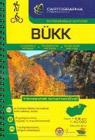
Der Atlas enthält sehr gute topografische Karten im Maßstab 1:40.000 über diese Wanderregion - mit zahlreichen Wanderwegmarkierungen. Die reich bebilderten Texte machen etwa die Hälfte des Werkes aus und liegen ausnahmslos in ungarischer Sprache vor. Mit Übersichtskarte der Wanderwege, geomophologischer Übersichtskarte und Sonderkarten 1:20.000 der Wandergebiete um Ómassa und Szilásvárad. Ortsplan von Bogács, Bükkszentkereszt, Cserépfalu, Lillafüred, Szilvásvárad, Innenstadtplan von Eger. Ausdrücklich zu erwähnen ist die reich bebilderte Beschreibung der Kleinbahnen - so dass auch Eisenbahnfans auf ihre Kosten kommen.  Kartenausschnitt Kartenausschnitt
Kartenbeispiel
|
Bükk Atlas 1:40.000 Wanderatlas Ungarn (ungarisch) - Cartographia
EAN / ISBN: 9789633538449
Preis: EUR 24.90
|
| 


