Willkommen bei MapFox
Wurde Ihre Bestellung bestätigt? Wenn nicht - gab es evtl. ein SERVER-Problem! Bitte kontaktieren Sie uns! +++ Buchhändler-Anfragen erwünscht +++
Warenkorb
Artikel: 0 - € 0.00
Zur Kasse
Impressum Kontakt Versandkosten AGB
Saint Nicholas Ways (Türkei) Wanderführer (englisch, türkisch)
Aziz Nicolaos Yolları Upcountry Türkei
<< Türkei: Regionale Landkarten
<< Upcountry Ltd. Türkei
 
Cover

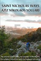
Wanderführer mit detaillierter Wanderkarte.

110 km of waymarked and signposted day-walks linking 6th C Byzantine monasteries.

An original guide book to a network of walking routes in the hills above Demre/Myra on the southern Turkish coast - St Nicholas Ways. Includes the sites of Sion, Alacahisar, Alakilise and other monastery churches

All the info you need to plan your daywalks, detailed descriptions and times for each section and info about historic places, large and small along the routes.

This new edition incorporates a general history of the area, a detailed history of St Nicholas and a description of his treasures.

Saint Nicholas Ways (Türkei) Wanderführer (englisch, türkisch)
Aziz Nicolaos Yolları Upcountry Türkei
Preis: EUR 19.90

sofort versandfertig Dieser Artikel ist im Normalfall sofort lieferbar.
Produkt EUR Anzahl Bestellen
Saint Nicholas Ways (Türkei) Wanderführer (englisch, türkisch)
Aziz Nicolaos Yolları Upcountry Türkei
19.90
Versandkostenfrei in Deutschland ab 30,- Bestellwert

incl. MwSt.

Stichworte, die bei der Suche nützlich sein könnten:
Aziz Nicolaos Yollari - Aziz Nicolaos Yollari - Türkei - Türkeikarten - Türkei Landkarten - Türkei Karten - Türkei Straßenkarten - Türkei Atlanten - Türkei Regionalkarten - Türkei Wanderkarten - Türkei Provinzkarten - Upcountry - Türkei - Türkei Reiseführer - Türkei Wanderführer - Lykischer Weg - türkischer Wanderführer

Zuletzt angesehene Artikel:

CoverSaint Nicholas Ways (Türkei) Wanderführer (englisch, türkisch)
Aziz Nicolaos Yolları Upcountry Türkei

Noch kein Cover vorhandenAutour d´Avignon - Provence des Papes à pied - Les Incontournables Wanderführer (französisch) Chamina - Frankreich

CoverLake District winter climbs Cicerone (englisch)

Noch kein Cover vorhanden147.2 Amtliche topographische Karte 1:50.000 Polen

CoverSüdost-England Straßenkarte 1:300.000 - London - Brighton - York Kümmerly + Frey
South East England

Noch kein Cover vorhandenStorfjorden - Ytre del med Hjørundfjorden - Seekarte Norwegische Küste 1:50.000 - (Blatt 126) Den Norske Kyst
Sjøkart - Hovedkart (sjø) Statens Kartverk Sjø - Norwegen

Noch kein Cover vorhanden7418 Nagold Topographische Landkarte 1:25.000 - Landesvermessungsamt Baden-Württemberg