Willkommen bei MapFox
Wurde Ihre Bestellung bestätigt? Wenn nicht - gab es evtl. ein SERVER-Problem! Bitte kontaktieren Sie uns! +++ Buchhändler-Anfragen erwünscht +++
Warenkorb
Artikel: 0 - € 0.00
Zur Kasse
Widerruf Impressum Kontakt Versandkosten AGB
Marokko-Erfahren
<< Marokko
<< Verlage
<< Marokko: Straßenkarten von ProjektNord


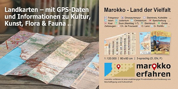
Gern "verstecken" wir, Andreas und Barbara Conrad uns hinter dem Namen marokko erfahren, der doch so viel mehr von unseren Gedanken und Zielen verrät.

Seit 1991, dem Jahr unseres ersten Besuches im Land waren wir von Marokkos kultureller Vielfalt, der Offenheit, Freundlichkeit und Gastfreundschaft seiner Bewohner fasziniert.

Baukunst und Historie der Imazighen ("Berber") begeisterte uns immer mehr und bei der intensiven Beschäftigung mit Kultur und Geschichte stießen wir auf weitere touristisch interessante Sehenswürdigkeiten: nicht nur die Dinosaurier haben hier Spuren hinterlassen, auch für die frühzeitliche Besiedlung durch den Menschen gibt es zahlreiche Zeugnisse.

Unser Projekt, möglichst vielen Menschen die bekannten und unbekannten kulturellen Sehenswürdigkeiten nahe zu bringen, nahm Form an. Mit unseren Publikationen - begleitet von guter Kartographie durch Prof. Dr. Uwe Ulrich Jäschke aus Dresden kann jede Zielgruppe ihre Wunschziele erreichen, kann individuell Marokko erfahren. Zugleich führt diese Öffentlichkeit zu angemessener Wertschätzung der Sehenswürdigkeiten und möglicherweise zum Erhalt der teilweise aufgegebenen Kulturschätze.

Produkt EUR Anzahl Bestellen
CoverGPS Waypoints Marokko - Morocco - Maroc www.marokko-erfahren.de - ProjektNord Details...
Grünes Karosymbol 14.90
Versandkostenfrei in Deutschland ab 30,- Bestellwert

incl. MwSt.
CoverStadtplan Agadir - Cityplan Inezgane 1:15.000 + GPS-Waypoints Marokko Touristische Karte - Mit Ausflugstipps - www.marokko-erfahren.de - ProjektNord Details...
Grünes Karosymbol 14.90
Versandkostenfrei in Deutschland ab 30,- Bestellwert

incl. MwSt.
CoverJ10: Essaouira - Sidi Kaouki - Jbel El Hadid 1:120.000 + GPS-Waypoints + Altstadtplan Essaouira - Marokko Touristische Karte - von Conrad, A. &. B - www.marokko-erfahren.de + Huber Kartographie Details...
Gelbes Karosymbol 24.90
Versandkostenfrei in Deutschland ab 30,- Bestellwert

incl. MwSt.
CoverJ12: Agadir - Taghazout - Imouzzer 1:120.000 + GPS-Waypoints Marokko Touristische Karte - Mit Cityplan Agadir - www.marokko-erfahren.de - ProjektNord Details...
Grünes Karosymbol 24.90
Versandkostenfrei in Deutschland ab 30,- Bestellwert

incl. MwSt.
CoverK13: Tafraoute nord - Tizourgane - Igherm 1:120.000 + GPS-Waypoints Marokko Touristische Karte - Straße der Agadire / IGOUDAR - www.marokko-erfahren.de - ProjektNord Details...
Grünes Karosymbol 24.90
Versandkostenfrei in Deutschland ab 30,- Bestellwert

incl. MwSt.
CoverK14: Tafraoute - Amtoudi - Aït Mansour - Tanalt 1:120.000 + GPS-Waypoints Marokko Touristische Karte - www.marokko-erfahren.de - ProjektNord Details...
Grünes Karosymbol 24.90
Versandkostenfrei in Deutschland ab 30,- Bestellwert

incl. MwSt.
CoverK15: Amtoudi - Fam El Hisn - Ifrane - Taghjijt 1:120.000 + GPS-Waypoints Marokko Touristische Karte - www.marokko-erfahren.de - ProjektNord Details...
Grünes Karosymbol 24.90
Versandkostenfrei in Deutschland ab 30,- Bestellwert

incl. MwSt.
CoverL11: Asni - Imlil - Oukaïmeden - Setti-Fatma 1:120.000 + GPS-Waypoints + Mit Wanderkarte Toubkal & Lac d`Ifni 1:62.000 Marokko Touristische Karte - www.marokko-erfahren.de - ProjektNord Details...
Grünes Karosymbol 24.90
Versandkostenfrei in Deutschland ab 30,- Bestellwert

incl. MwSt.
CoverL11: Asni - Imlil - Oukaïmeden - Setti-Fatma 1:120.000 + GPS-Waypoints + Mit Wanderkarte Toubkal & Lac d`Ifni 1:62.000 *** SCHNÄPPCHEN *** Marokko Touristische Karte - www.marokko-erfahren.de - ProjektNord Details...
Grünes Karosymbol 20.00
Versandkostenfrei in Deutschland ab 30,- Bestellwert

incl. MwSt.
CoverL12: Taliouine - Aoulouz - Askoun - Agadir Melloul - Jbel Sirwa + GPS-Waypoints 1:120.000 Marokko Touristische Karte - www.marokko-erfahren.de + Huber Kartographie Details...
Grünes Karosymbol 24.90
Versandkostenfrei in Deutschland ab 30,- Bestellwert

incl. MwSt.
CoverL14: Tata - Akka - Tadakoust - Jbel Bani + GPS-Waypoints Marokko Touristische Karte - www.marokko-erfahren.de - ProjektNord Details...
Grünes Karosymbol 24.90
Versandkostenfrei in Deutschland ab 30,- Bestellwert

incl. MwSt.
CoverM11: Aït Ben Haddou - Ouarzazate - Skoura + Straße der Kasbahs I 1:120.000 + GPS-Waypoints Marokko Touristische Karte - www.marokko-erfahren.de - ProjektNord Details...
Grünes Karosymbol 24.90
Versandkostenfrei in Deutschland ab 30,- Bestellwert

incl. MwSt.
CoverM12: Taznakht - Anzal - Aït Saoun - Alloughoum - Jbel Sirwa est 1:120.000 + GPS-Waypoints Marokko Touristische Karte - www.marokko-erfahren.de - Kartographie Huber Details...
Grünes Karosymbol 24.90
Versandkostenfrei in Deutschland ab 30,- Bestellwert

incl. MwSt.
CoverM13: Foum Zguid - Tissint - PN d´Iriqui ouest - Jbel Bani Marokko Touristische Karte - von Conrad, A. +. B - Huber Kartographie Details...
Gelbes Karosymbol 24.90
Versandkostenfrei in Deutschland ab 30,- Bestellwert

incl. MwSt.
CoverN11: Skoura - Kelâa M’Gouna - N’Kob - Jbel Sarhro + Straße der Kasbahs II - 1:120.000 + GPS-Waypoints - Marokko Touristische Karte - www.marokko-erfahren.de - Kartographie Huber Details...
Gelbes Karosymbol 24.90
Versandkostenfrei in Deutschland ab 30,- Bestellwert

incl. MwSt.
CoverN12: Agdz - Zagora - Vallée du Drâa - 1:120.000 + GPS-Waypoints - Marokko Touristische Karte - www.marokko-erfahren.de - Kartographie Huber Details...
Gelbes Karosymbol 24.90
Versandkostenfrei in Deutschland ab 30,- Bestellwert

incl. MwSt.
CoverN10: Aït Bouguemez - M’Semrir - Boumalne Dadès - Kelâa M’Gouna + Straße der Kasbahs III + GPS-Waypoints - Marokko Touristische Karte - www.marokko-erfahren.de - Kartographie Huber Details...
Gelbes Karosymbol 24.90
Versandkostenfrei in Deutschland ab 30,- Bestellwert

incl. MwSt.
CoverO10: Tinghir - Tinejdad - Goulmima - Oued Todgha + Straße der Kasbahs IV + GPS-Waypoints - Marokko Touristische Karte - www.marokko-erfahren.de - Kartographie Huber Details...
Gelbes Karosymbol 24.90
Versandkostenfrei in Deutschland ab 30,- Bestellwert

incl. MwSt.


Zuletzt angesehene Artikel:

CoverSouth West Coast Path 1 - Von Minehead nach St. Ives - Wanderkarte 1:40.000 National Trail - HARVEY MAPS
South West Coast Path 1 - Minehead to St Ives - National Trail Map

CoverToubkal & Marrakesch (Atlasgebirge) Topographische Wanderkarte 1:50.000 wasserfest - Marokko
Toubkal & Marrakech 1:50.000 - Morocco Cordee

CoverTennengebirge - Hochkönig - Hallein - Bischofshofen 1:50.000 (Blatt 15) - Wanderkarte mit Broschüre KOMPASS

CoverRepublik Mordwinien Topographische Landkarte 1:200.000
Respublika Mordowija - Russland

Noch kein Cover vorhandenBC33 Topographische Landkarte Neuseeland 1:50.000 Land Information New Zealand

CoverTeheran - Touristischer Stadtplan (Englisch) 1:35.000 (Blatt 1519)
Tourist Map of Tehran (English) / نقشه توريستي انگليسي Gitashenasi - Iran

Cover166 Trebicsko Fahrradkarte Tschechien 1:60.000 - SHOCart

Noch kein Cover vorhandenM-34-70-A/B Sieniawa Amtliche topographische Landkarte Polen 1:50.000
M-34-70-A/B Sieniawa - Mapa Topograficzna Polski Glowny Geodeta Kraju

CoverSeekajak OutdoorHandbuch - Basixx (Band 65) - Nehrhoff von Holderberg & Jahn Conrad-Stein-Verlag

CoverRadkarte Niederrhein Nord (RK-NRW03) - Esterbauer

Cover213 Aberystwyth & Cwm Rheidol - Wanderkarte Großbritannien 1:25.000 EXPLORER MAP - Ordnance Survey

Cover40D GENDT Topographische Karte der Niederlande 1:25.000 (Plotausgabe)
40D Topografische Kaart van Nederland Kadaster - ProjektNord

CoverDer Wanderführer: Sächsischer Weinwanderweg Heimatkundlicher Wanderführer und Touristenführer - Heimatbuchverlag

Cover425 Huntly & Cullen - Wanderkarte Großbritannien 1:25.000 EXPLORER MAP - Active Map LAMINIERT - Ordnance Survey

CoverL5154 Zittau 1:50.000 Amtliche Topografische Landkarte - Landesvermessungsamt Sachsen

CoverTourenAtlas Wasserwandern - TA3 Rhein-Mosel 1:75.000 Saar, Mosel, Rhein ab Mainz und Nebenflüsse - Jübermann

CoverGebrauchsanweisung für China - von Kai Strittmatter - Piper Verlag

CoverMadeira (Porto Santo, Funchal) 1:60.000 Nelles-Map
Madeira Nelles-Verlag

CoverS41 Topographische Karte 1:100.000 EUREF-FIN Maanmittauslaitos / Lantmäteriverket Finnland - ProjektNord

Noch kein Cover vorhandenLillooet - TOPO (Blatt VCBC44) Topographische Landkarte - Backroad Topo Map Kanada