<< zurück
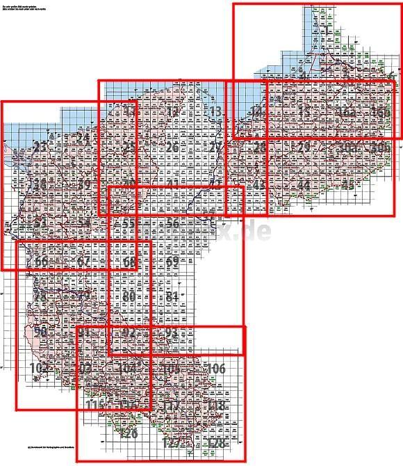
Bitte klicken Sie auf die gewünschte Region!
Zuletzt angesehene Artikel:
 | 3442 Wachow Sonderausgabe mit Wanderwegen - Topographische Wanderkarte Brandenburg 1:25.000 ProjektNord |
 | 3142 Fehrbellin *** SCHNÄPPCHEN *** Topographische Karte 1:25.000 Landesvermessungsamt Brandenburg (gefaltet) |
 | Savoie - 50 balades à pied Sentiers Chamina Wanderführer - (französisch) Chamina - Frankreich |
 | N3144 Skaftung Topographische Karte 1:25.000 EUREF (Peruskartta) Maanmittauslaitos / Lantmäteriverket Finnland - ProjektNord |
 | 294 Topographische Landkarte Wanderkarte und Fahrradkarte Portugal 1:25.000
294 Mapa topográfico - Mapa de caminhadas - Portugal 1:25.000 ProjektNord |
 | U4133 Pasmajärvi Topographische Karte 1:25.000 EUREF (Peruskartta) Maanmittauslaitos / Lantmäteriverket Finnland - ProjektNord |
 | 2217-I Løkken - mit Wanderwegen und Fahrradrouten Topographische Fahrradkarte und Wanderkarte Dänemark 1:50.000 - Kort & Matrikelstyrelsen ProjektNord
2217-I Løkken - Topografisk Cykel- og Vandrekort Danmark |
 | L3728 Braunschweig (geplottete Ausgabe) Topographische Karte 1:50.000 Kartografie Landesvermessungsamt Niedersachsen - ProjektNord |
 | L2926 Amelinghausen (geplottete Ausgabe) Topographische Karte 1:50.000 Kartografie Landesvermessungsamt Niedersachsen - ProjektNord |
 | Durmitor (zentral) mit Wanderwegen und Radwegen - Wanderkarte - Fahrradkarte 1:20.000 Montenegro - ProjektNord |
 | W5144 Topographische Karte 1:25.000 EUREF (Peruskartta) Maanmittauslaitos / Lantmäteriverket Finnland - ProjektNord |
 | 2113-I Grindsted - mit Wanderwegen und Fahrradrouten Topographische Fahrradkarte und Wanderkarte Dänemark 1:50.000 - Kort & Matrikelstyrelsen ProjektNord
2113-I Grindsted - Topografisk Cykel- og Vandrekort Danmark |
 | Q4242 Yppäri Topographische Karte 1:25.000 EUREF (Peruskartta) Maanmittauslaitos / Lantmäteriverket Finnland - ProjektNord |
 | 2315-III Hadsten - mit Wanderwegen und Fahrradrouten Topographische Fahrradkarte und Wanderkarte Dänemark 1:50.000 - Kort & Matrikelstyrelsen ProjektNord
2315-III Hadsten - Topografisk Cykel- og Vandrekort Danmark |
 | Bonn - Ville Topographische Wanderkarte Nordrhein-Westfalen mit Wanderwegen und Radwegen 1:25.000 - ProjektNord |
 | 8344 Berchtesgaden Ost Topographische Landkarte Bayern 1:25.000 - Normalausgabe - ProjektNord (geplottete Ausgabe) - Grundlage amtliche Topographische Karte Bayern DTK25 |
 | 8242 Inzell Topographische Landkarte Bayern 1:25.000 - Normalausgabe - ProjektNord (geplottete Ausgabe) - Grundlage amtliche Topographische Karte Bayern DTK25 |
 | Vilnius (Wilna) *** SCHNÄPPCHEN *** Taschenstadtplan 1:50.000 (Litauen) - Jana Seta
Vilnius |
 | Die Haard Topographische Wanderkarte Nordrhein-Westfalen mit Wanderwegen und Radwegen 1:25.000 - ProjektNord |
 | 528 - Topographische Landkarte Portugal 1:25.000 Carta Militar de Portugal - Série M888 Instituto Geográfico do Exército (IGeoE) - Portugal |
