Willkommen bei MapFox
Wurde Ihre Bestellung bestätigt? Wenn nicht - gab es evtl. ein SERVER-Problem! Bitte kontaktieren Sie uns! +++ Buchhändler-Anfragen erwünscht +++
Warenkorb
Artikel: 0 - € 0.00
Zur Kasse
Widerruf Impressum Kontakt Versandkosten AGB
Forbidden Plateau and Campbell River 1:50.000 ITMB International Travel Maps (engl.)
<< Kanada: Provinzen
<< ITMB - International Travel Maps
 
Cover

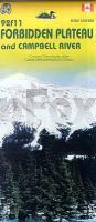
British Columbia’s Vancouver Island is a treasure trove of mountains and valleys waiting to be explored. The plateau, on the eastern side of the island, is neither forbidden nor formidable, but a major hiking and recreation area for local residents and visitors. Using Canada’s NTS topographic maps as a base, and adding all the touristic and outdoors activities we could find, we have created a double-sided map of two adjacent recreational areas. Campbell River itself is a fairly small, but attractive town. The map, however, is of the region west of the town, not particularly of the town itself, so both sides concentrate on the touristic potential. This is ITMB’s latest creation for BC, intending to provide top-level cartography along with up to date recreational and cultural information for everyone’s benefit.

Kartenausschnitt

Kartenbeispiel

Forbidden Plateau and Campbell River 1:50.000 ITMB International Travel Maps (engl.)
EAN / ISBN: 9781553418115
Preis: EUR 11.90

sofort versandfertig Dieser Artikel ist im Normalfall sofort lieferbar.
Produkt EUR Anzahl Bestellen
Forbidden Plateau and Campbell River 1:50.000 ITMB International Travel Maps (engl.) 11.90
Versandkostenfrei in Deutschland ab 30,- Bestellwert

incl. MwSt.

Stichworte, die bei der Suche nützlich sein könnten:
Campbell River - Forbidden Plateau - ITMB - ITM - International Travel Maps - ITMB Internationale Landkarten - ITB-Karten - ITMB-Karten - International Travel Maps and Books - Kanada Provinzen - Kanada Bundesstaaten

Zuletzt angesehene Artikel:

CoverForbidden Plateau and Campbell River 1:50.000 ITMB International Travel Maps (engl.)

CoverYorkshire 3 Peaks Challenge Map - Super-Durable Map Wanderkarte (wasserfest) Discovery Walking Guides Ltd

Noch kein Cover vorhanden272.42 Amtliche topographische Karte 1:25.000 Polen

Noch kein Cover vorhanden511.2 Amtliche topographische Karte 1:50.000 Polen

Cover36 Ticino - Sopra Ceneri MTB-Karte 1:50.000 - Swiss Singletrail Map

CoverThe Colorado 14ers A Colorado Mountain Club Pack Guide - Colorado Trail Foundation - THE MOUNTAINEERS

Cover255 Llangollen & Berwyn - Wanderkarte Großbritannien 1:25.000 EXPLORER MAP - Active Map LAMINIERT - Ordnance Survey

Noch kein Cover vorhanden102.44 Amtliche topographische Karte 1:25.000 Polen

Noch kein Cover vorhanden333.43 Amtliche topographische Karte 1:25.000 Polen

Noch kein Cover vorhanden356.12 Amtliche topographische Karte 1:25.000 Polen

Noch kein Cover vorhanden531.31 Amtliche topographische Karte 1:25.000 Polen

CoverTH05 Table Cape 1:50.000 Topographische Landkarte Tasmanien - Australien - Tasmap (Tasmanien)

Noch kein Cover vorhanden202.44 Amtliche topographische Karte 1:25.000 Polen

Noch kein Cover vorhanden143.32 Amtliche topographische Karte 1:25.000 Polen

CoverBitburger Land 4 Topographische Wanderkarte Rheinland-Pfalz mit Wanderwegen und Radwegen 1:25.000 - ProjektNord

Noch kein Cover vorhanden401.43 Amtliche topographische Karte 1:25.000 Polen

Noch kein Cover vorhanden221.43 Amtliche topographische Karte 1:25.000 Polen

Noch kein Cover vorhanden182.1 Amtliche topographische Karte 1:50.000 Polen

CoverIsle of Wight 1:32.000 Wanderkarte - Discovery Walking Guides Ltd

Noch kein Cover vorhanden132.43 Amtliche topographische Karte 1:25.000 Polen