| << Portugal: Amtliche topografische Landkarten des Instituto Geográfico do Exército (IGeoE) 1:25.000 (Serie M888) |
||
|
||

Zuletzt angesehene Artikel:
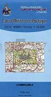
 | 394 - Topographische Landkarte Portugal 1:25.000 Carta Militar de Portugal - Série M888 Instituto Geográfico do Exército (IGeoE) - Portugal |
 | Izmir - Topographische Umgebungskarte 1:25.000 Türkei (Blatt 5.1) Landkarte İzmir ProjektNord |
 | Sachsen (Nr. 3708) *** SCHNÃPPCHEN *** GroÃraum-Radtourenkarte 1:125.000 - KOMPASS-Karten |
 | Reisen in Mosambik *** SCHNÃPPCHEN *** Mosambik Komplett mit allen Nationalparks, interessanten Allradstrecken und wertvollen GPS-Daten - Reiseführer von Ilona Hupe und Manfred Vachal - Ilona Hupe Verlag |
 | 0440-1 BELCHITE Topographische Landkarte 1:25.000 Spanien (Grundlage MTN25) Instituto Geográfico Nacional - CNIG Spanien - ProjektNord |
 | 303 Topographische Landkarte Wanderkarte und Fahrradkarte Portugal 1:25.000 303 Mapa topográfico - Mapa de caminhadas - Portugal 1:25.000 ProjektNord |
 | 228 - Quiaios (Figueira da Foz) - Topographische Landkarte Portugal 1:25.000 Carta Militar de Portugal - Série M888 Instituto Geográfico do Exército (IGeoE) - Portugal |
 | 180 - Topographische Landkarte Portugal 1:25.000 Carta Militar de Portugal - Série M888 Instituto Geográfico do Exército (IGeoE) - Portugal |
 | 4052-SO Topographische Karte 1:10.000 - Landesvermessungsamt Brandenburg |
 | Ghana Praktisches Reisehandbuch für die »Goldküste« Westafrikas von Jojo Cobbinah - PETER MEYER REISEFÃHRER pmv Peter Meyer Verlag |
 | 484-3 BUSTARVIEJO Amtliche topographische Landkarte 1:25.000 Spanien (M.T.N.) 484-3 Mapa Topográfico Nacional de Espana (MTN25) Instituto Geográfico Nacional - CNIG Spanien |
 | 11 - Mofreita (Vinhais) Topographische Landkarte Portugal 1:25.000 Carta Militar de Portugal - Série M888 Instituto Geográfico do Exército (IGeoE) - Portugal |
 | 507 - Topographische Landkarte Portugal 1:25.000 Carta Militar de Portugal - Série M888 Instituto Geográfico do Exército (IGeoE) - Portugal |
 | 07W GRONINGEN (West) Topographische Karte der Niederlande 1:50.000 Topografische Dienst (Plotausgabe) |
 | 607 Moncarapacho (Olhao) Topographische Landkarte Portugal 1:25.000 Carta Militar de Portugal - Série M888 Instituto Geográfico do Exército (IGeoE) - Portugal |
 | 1012 (22-41) Fiñana Amtliche topographische Landkarte 1:50.000 Spanien (M.T.N.) 1012 Mapa Topográfico Nacional de Espana (MTN50) Instituto Geográfico Nacional - CNIG Spanien |
 | 427 - Topographische Landkarte Portugal 1:25.000 Carta Militar de Portugal - Série M888 Instituto Geográfico do Exército (IGeoE) - Portugal |
 | 901 Villaviciosa de Córdoba Amtliche topographische Landkarte 1:50.000 Spanien (M.T.N.) 901 Mapa Topográfico Nacional de Espana (MTN50) Instituto Geográfico Nacional - CNIG Spanien |
 | L3506 Neuenhaus (geplottete Ausgabe) Topographische Karte 1:50.000 Kartografie Landesvermessungsamt Niedersachsen - ProjektNord |
 | 5706 Hillesheim - Wanderkarte mit Wanderwegen (geplottete Ausgabe) ProjektNord - Grundlage Amtliche topographische Karte Landesamt für Vermessung und Geobasisinformation Rheinland-Pfalz |