| << Portugal: Amtliche topografische Landkarten des Instituto Geográfico do Exército (IGeoE) 1:25.000 (Serie M888) |
||
|
||

Zuletzt angesehene Artikel:
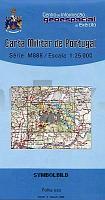
 | 481 - Topographische Landkarte Portugal 1:25.000 Carta Militar de Portugal - Série M888 Instituto Geográfico do Exército (IGeoE) - Portugal |
 | Ormea - Garessio - Castelbianco - Aquila d`Arroscia (Blatt SV-9) Topographische Wanderkarte 1:25.000 Carta dei Sentieri EdM - Edizioni del Magistero - Italien |
 | Jordanien Landkarte 1:610.000 und Syrien Landkarte 1:740.000 (engl.) *** SCHNÃPPCHEN *** Jordan and Syria ITMB International Travel Maps (engl.) |
 | 5922 Frammersbach Topographische Landkarte Bayern 1:25.000 - Normalausgabe - ProjektNord (geplottete Ausgabe) - Grundlage amtliche Topographische Karte Bayern DTK25 |
 | Wesel Südwest Topographische Wanderkarte Nordrhein-Westfalen mit Wanderwegen und Radwegen 1:25.000 - ProjektNord |
 | Sachaliner Oblast Topografischer Atlas 1:200.000 / 1:500.000 Sahalinskaja oblastj - Atlas avtodorog - Russland |
 | 4223 (NL 33-02-23) Weiz Topographische Wanderkarte 1:50.000 mit Wegmarkierungen - Ãsterreich - Kartographie BEV - ProjektNord |
 | Q5124 Lahnasjärvi Topographische Karte 1:25.000 EUREF (Peruskartta) Maanmittauslaitos / Lantmäteriverket Finnland - ProjektNord |
 | M16 Eggenfelden mit Falkenberg, Mitterskirchen, Hebertsfelden, Schönau, Massing, Wurmannsquick *** SCHNÃPPCHEN *** ATK25 Topographische Karte 1:25.000 (Atkis) Bayern Landesvermessungsamt Bayern - Wanderkarte |
 | L5112 Haapasaari Topographische Karte 1:25.000 EUREF (Peruskartta) Maanmittauslaitos / Lantmäteriverket Finnland - ProjektNord |
 | Q534 Saunajärvi Topographische Karte 1:50.000 EUREF-FIN (Maastokarttat) Maanmittauslaitos / Lantmäteriverket Finnland - ProjektNord |
 | Baedeker Reiseführer Harz MAIRDUMONT |
 | 8631 Zugspitze Süd Topographische Landkarte Bayern 1:25.000 - Normalausgabe - ProjektNord (geplottete Ausgabe) - Grundlage amtliche Topographische Karte Bayern DTK25 |
 | L4128 Goslar (geplottete Ausgabe) Topographische Karte 1:50.000 Kartografie Landesvermessungsamt Niedersachsen - ProjektNord |
 | L3928 Salzgitter (geplottete Ausgabe) Topographische Karte 1:50.000 Kartografie Landesvermessungsamt Niedersachsen - ProjektNord |
 | 6127 Volkach Topographische Landkarte Bayern 1:25.000 - Normalausgabe - ProjektNord (geplottete Ausgabe) - Grundlage amtliche Topographische Karte Bayern DTK25 |
 | 5504 Arlberg - Lech - St. Anton am Arlberg - Verwallgruppe Landkarte *** SCHNÃPPCHEN *** Wanderkarte, Radwanderkarte, Freizeitkarte - Freytag & Berndt |
 | 3048 Joachimsthal Sonderausgabe mit Wanderwegen - Topographische Wanderkarte Brandenburg 1:25.000 ProjektNord |
 | Erfurt - Mittelthüringen Fahrradkarte 1:75.000 - Grünes Herz |
 | Sisimiut - Kangerlussuaq - Maniitsoq 1:370.000 Topographische Landkarte (Grüne Serie) Saga Maps Grönland Holsteinsborg - Søndre Strømfjord - Sukkertoppen |