| << Portugal: Amtliche topografische Landkarten des Instituto Geográfico do Exército (IGeoE) 1:25.000 (Serie M888) |
||
|
||

Zuletzt angesehene Artikel:
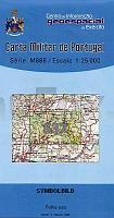
 | 537 - Topographische Landkarte Portugal 1:25.000 Carta Militar de Portugal - Série M888 Instituto Geográfico do Exército (IGeoE) - Portugal |
 | 0209-1 ENA Topographische Landkarte 1:25.000 Spanien (Grundlage MTN25) Instituto Geográfico Nacional - CNIG Spanien - ProjektNord |
 | 0615-3 CIRAT Topographische Landkarte 1:25.000 Spanien (Grundlage MTN25) Instituto Geográfico Nacional - CNIG Spanien - ProjektNord |
 | 0755-2 CASAS DE DON PEDRO Topographische Landkarte 1:25.000 Spanien (Grundlage MTN25) Instituto Geográfico Nacional - CNIG Spanien - ProjektNord |
 | 0157-3 A SEARA Topographische Landkarte 1:25.000 Spanien (Grundlage MTN25) Instituto Geográfico Nacional - CNIG Spanien - ProjektNord |
 | 4246-NO Topographische Karte 1:10.000 - Landesvermessungsamt Brandenburg |
 | 105 Sestriere - Claviere - Sansicario - Prali - Topographische Wanderkarte 1:25.000 Val Chisone - Val di Susa - Val Germanasca - Val di Thures - IGC Italien |
 | 2812-II-Nà Svaneke Topographische Karte Dänemark 1:25.000 Topografisk kort Danmark (DTK/Kort25) 2812-II-Nà ProjektNord - Kort & Matrikelstyrelsen / Geodætisk Institut |
 | 2413-III-Sà Topographische Karte Dänemark 1:25.000 Topografisk kort Danmark (DTK/Kort25) 2413-III-Sà ProjektNord - Kort & Matrikelstyrelsen / Geodætisk Institut |
 | 0426 FUENTESAÃCO Topographische Landkarte 1:50.000 Spanien (Grundlage MTN50) Instituto Geográfico Nacional - CNIG Spanien - ProjektNord |
 | 851 Rabito Amtliche topographische Landkarte 1:50.000 Spanien (M.T.N.) 851 Mapa Topográfico Nacional de Espana (MTN50) Instituto Geográfico Nacional - CNIG Spanien |
 | 2312-IV-Sà Topographische Karte Dänemark 1:25.000 Topografisk kort Danmark (DTK/Kort25) 2312-IV-Sà ProjektNord - Kort & Matrikelstyrelsen / Geodætisk Institut |
 | 0509-2 TORRELAGUNA Topographische Landkarte 1:25.000 Spanien (Grundlage MTN25) Instituto Geográfico Nacional - CNIG Spanien - ProjektNord |
 | 1094 El Castillo - Fuerteventura Amtliche topographische Landkarte 1:50.000 Spanien (M.T.N.) 1094 Mapa Topográfico Nacional de Espana (MTN50) Instituto Geográfico Nacional - CNIG Spanien |
 | 287 Alvaiázere Topographische Landkarte Wanderkarte und Fahrradkarte Portugal 1:25.000 287 Mapa topográfico - Mapa de caminhadas - Portugal 1:25.000 ProjektNord |
| 3339-NO Topographische Karte 1:10.000 - Landesvermessungsamt Brandenburg |
 | 0143-1 GÃESA/GORZA Topographische Landkarte 1:25.000 Spanien (Grundlage MTN25) Instituto Geográfico Nacional - CNIG Spanien - ProjektNord |
 | 2116-IV-Nà Topographische Karte Dänemark 1:25.000 Topografisk kort Danmark (DTK/Kort25) 2116-IV-Nà ProjektNord - Kort & Matrikelstyrelsen / Geodætisk Institut |
 | 0046-1 PADERNE Topographische Landkarte 1:25.000 Spanien (Grundlage MTN25) Instituto Geográfico Nacional - CNIG Spanien - ProjektNord |
 | 566 Cella Amtliche topographische Landkarte 1:50.000 Spanien (M.T.N.) 566 Mapa Topográfico Nacional de Espana (MTN50) Instituto Geográfico Nacional - CNIG Spanien |