| << Portugal: Amtliche topografische Landkarten des Instituto Geográfico do Exército (IGeoE) 1:25.000 (Serie M888) |
||
|
||

Zuletzt angesehene Artikel:
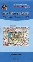
 | 576 Rogil (Aljezur) Topographische Landkarte Portugal 1:25.000 Carta Militar de Portugal - Série M888 Instituto Geográfico do Exército (IGeoE) - Portugal |
 | 4208 Wulfen (geplottete Ausgabe) Amtliche topographische Karte 1:25.000 Landesvermessungsamt Nordrhein-Westfalen |
 | 3647 Wildau Sonderausgabe mit Wanderwegen - Topographische Wanderkarte Brandenburg 1:25.000 ProjektNord |
 | Zwickauer Mulde - Rochlitz - Lunzenau (Blatt 12) Topographische Wanderkarte 1:25.000 mit Wanderwegen - ProjektNord |
 | 4 Norra Svealand / Södra Norrland *** SCHNÃPPCHEN *** StraÃenkarte 1:250.000 Landkarte Kartförlaget Schweden |
 | 6416 Mannheim Nordwest - Wanderkarte mit Wanderwegen (geplottete Ausgabe) ProjektNord - Grundlage Amtliche topographische Karte Landesamt für Vermessung und Geobasisinformation Rheinland-Pfalz |
 | Dramburger Seenplatte Westteil 1:50.000 Topographische Wanderkarte Polen - wasserfest Pojezierze Drawskie część zachodnia - wodoodporna PLAN Galileos - Polen |
 | Elbing Kreiskarte des Deutschen Reiches 1:100.000 (KDR 100 KK) - Faksimile Reichsamt für Landesaufnahme |
 | 106 Camporredondo de Alba Amtliche topographische Landkarte 1:50.000 Spanien (M.T.N.) 106 Mapa Topográfico Nacional de Espana (MTN50) Instituto Geográfico Nacional - CNIG Spanien |
 | 0307-2 SANTA CROYA DE TERA Topographische Landkarte 1:25.000 Spanien (Grundlage MTN25) Instituto Geográfico Nacional - CNIG Spanien - ProjektNord |
 | Crossen Kreiskarte des Deutschen Reiches 1:100.000 (KDR 100 KK) - Faksimile Reichsamt für Landesaufnahme |
 | 470 - Topographische Landkarte Portugal 1:25.000 Carta Militar de Portugal - Série M888 Instituto Geográfico do Exército (IGeoE) - Portugal |
 | 1112-II Løgumkloster Topographische Karte Dänemark 1:50.000 Kort & Matrikelstyrelsen / Geodætisk Institut |
 | 0146 MONTE PERDIDO Topographische Landkarte 1:50.000 Spanien (Grundlage MTN50) Instituto Geográfico Nacional - CNIG Spanien - ProjektNord |
 | 449 Topographische Landkarte Wanderkarte und Fahrradkarte Portugal 1:25.000 449 Mapa topográfico - Mapa de caminhadas - Portugal 1:25.000 ProjektNord |
 | 117 - Topographische Landkarte Portugal 1:25.000 Carta Militar de Portugal - Série M888 Instituto Geográfico do Exército (IGeoE) - Portugal |
| Irkutsker Oblast - StraÃenkarte 1:1 Mio. / 1:1.2 Mio. Irkutskaja Oblast` Karta awtomobilnyh dorog VostSib AGP - Russland |
 | 4317 Geseke (geplottete Ausgabe) Amtliche topographische Karte 1:25.000 Landesvermessungsamt Nordrhein-Westfalen |
 | 10039 Hardangerjøkulen Topographische Landkarte 1:50.000 Norge-serien - Nordeca Norwegen |
| 3141-SO Topographische Karte 1:10.000 - Landesvermessungsamt Brandenburg |