Willkommen bei MapFox
Wurde Ihre Bestellung bestätigt? Wenn nicht - gab es evtl. ein SERVER-Problem! Bitte kontaktieren Sie uns! +++ Buchhändler-Anfragen erwünscht +++
Warenkorb
Artikel: 0 - € 0.00
Zur Kasse
Impressum Kontakt Versandkosten AGB
La Route Buissonnière - Route historique 1:250.000 *** SCHNÄPPCHEN *** Gâtinais - Puisaye - Vallée de l´Yonne - Morvan - Charolais - Vallée de l´Azergue - Culture & Environnement / Kultur und Natur - IGN Frankreich
<< Frankreich: Regionale Freizeitkarten und Landkarten Kultur und Natur des IGN
<< Schnäppchen - Restposten - Mängelexemplare
 
Cover

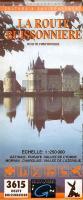
Touristische Landkarte über den Historischen Weg Route Buissonnière zwischen Fontainebleau und Lyon. Mitverschiedenen Nebenrouten. Schiffbare Kanäle sind besonders gekennzeichnet.

Ausgabe von 1995. Verkauf solange der Vorrat reicht.

Kartenausschnitt

Kartenbeispiel

La Route Buissonnière - Route historique 1:250.000 *** SCHNÄPPCHEN *** Gâtinais - Puisaye - Vallée de l´Yonne - Morvan - Charolais - Vallée de l´Azergue - Culture & Environnement / Kultur und Natur - IGN Frankreich
EAN / ISBN: 3282118302314
Preis: EUR 2.00

sofort versandfertig Dieser Artikel ist im Normalfall sofort lieferbar.
Produkt EUR Anzahl Bestellen
La Route Buissonnière - Route historique 1:250.000 *** SCHNÄPPCHEN *** Gâtinais - Puisaye - Vallée de l´Yonne - Morvan - Charolais - Vallée de l´Azergue - Culture & Environnement / Kultur und Natur - IGN Frankreich 2.00
Versandkostenfrei in Deutschland ab 30,- Bestellwert

incl. MwSt.

Stichworte, die bei der Suche nützlich sein könnten:
Route Buissonnière - Route Buissonniere - Frankreich - IGN - Plein Air - Cultur et Nature - Schnäppchen - Sonderangebote - Restposten

Zuletzt angesehene Artikel:

CoverLa Route Buissonnière - Route historique 1:250.000 *** SCHNÄPPCHEN *** Gâtinais - Puisaye - Vallée de l´Yonne - Morvan - Charolais - Vallée de l´Azergue - Culture & Environnement / Kultur und Natur - IGN Frankreich

Cover3913 11 Fallak Topographische Karte 1:20.000 (Maastokartta / Peruskartta / Grundkarta) Maanmittauslaitos / Lantmäteriverket Finnland - ProjektNord

Cover4212 11 Säimen Topographische Karte 1:20.000 (Maastokartta / Peruskartta / Grundkarta) Maanmittauslaitos / Lantmäteriverket Finnland - ProjektNord

Cover3732 02 Allema-Aapa Topographische Karte 1:20.000 (Maastokartta / Peruskartta / Grundkarta) Maanmittauslaitos / Lantmäteriverket Finnland - ProjektNord

Noch kein Cover vorhandenErläuterungen zur Geologischen Karte 5240 Zwickau-Werdau (111) - Ausgabe 1900 Sächsisches Landesamt für Umwelt, Landwirtschaft und Geologie

Cover580 Ameixial (Loulé) Topographische Landkarte Wanderkarte und Fahrradkarte Portugal 1:25.000
580 Mapa topográfico - Mapa de caminhadas - Portugal 1:25.000 ProjektNord

CoverKarelische Landenge: Wuoksa See - touristische Landkarte 1:25.000 Karta LTD Sankt Petersburg
Karelskij perescheek: Osero Wuoksa - Karta dlja turistow

Cover5011 Wiehl - Wanderkarte mit Wanderwegen (geplottete Ausgabe) ProjektNord - Grundlage Amtliche topographische Karte 1:25.000 Landesvermessungsamt Nordrhein-Westfalen

Cover11D HEERENVEEN Topographische Karte der Niederlande 1:25.000 (Plotausgabe)
11D HEERENVEEN Topografische Kaart van Nederland Kadaster - ProjektNord

Cover7041 Münster Topographische Landkarte Bayern 1:25.000 - Normalausgabe - ProjektNord (geplottete Ausgabe) - Grundlage amtliche Topographische Karte Bayern DTK25

Cover39E RHENEN Topographische Karte der Niederlande 1:25.000 (Plotausgabe)
39E RHENEN Topografische Kaart van Nederland Kadaster - ProjektNord

CoverMalerweg in der Sächsischen Schweiz - Wander- und Radwanderkarte mit Zick-Zack-Faltung 1:20.000 (Nr. 204) Die beliebte Wanderung von Liebethal nach Wehlen, Bad Schandau zum Großen Winterberg und zurück über Gohrisch, Königstein und Struppen nach Pirna. Wander- und Radwanderkarte, GPS-fähig. Wetterfest, reißfest. 1:20000 Dr. Barthel Verlag

CoverFlutgrabenaue, Königs Wusterhausen und Umgebung - Radwander- und Wanderkarte 1:35.000 (Nr. 097) Ausflüge zwischen Zossen, Prieros, Gosen-Neu Zittau, Groß Köris und Mittenwalde. 1:35000. Radwander- und Wanderkarte Dr. Barthel Verlag

Cover8627 Einödsbach Topographische Landkarte Bayern 1:25.000 - Normalausgabe - ProjektNord (geplottete Ausgabe) - Grundlage amtliche Topographische Karte Bayern DTK25

Cover4107 Borken - Wanderkarte mit Wanderwegen (geplottete Ausgabe) ProjektNord - Grundlage Amtliche topographische Karte 1:25.000 Landesvermessungsamt Nordrhein-Westfalen

Cover6541 Tiefenbach Topographische Landkarte Bayern 1:25.000 - Normalausgabe - ProjektNord (geplottete Ausgabe) - Grundlage amtliche Topographische Karte Bayern DTK25

Noch kein Cover vorhanden5243 Burkhardtsdorf (114) - Geologische Karte 1:25.000 (GK25) Grundlage Vollbornsche Äquidistantenkarte Sächsisches Landesamt für Umwelt, Landwirtschaft und Geologie

Cover4120 Steinheim - Wanderkarte mit Wanderwegen (geplottete Ausgabe) ProjektNord - Grundlage Amtliche topographische Karte 1:25.000 Landesvermessungsamt Nordrhein-Westfalen

Cover2441 11 Relletti Topographische Karte 1:20.000 (Maastokartta / Peruskartta / Grundkarta) Maanmittauslaitos / Lantmäteriverket Finnland - ProjektNord

Cover7430 Wertingen Topographische Landkarte Bayern 1:25.000 - Normalausgabe - ProjektNord (geplottete Ausgabe) - Grundlage amtliche Topographische Karte Bayern DTK25