| << Cookinseln - Tokelau-Inseln - Niue - Kermadecinseln |
||
|
||
Zuletzt angesehene Artikel:
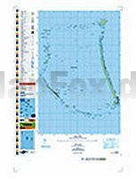
 | PI02 Nukunonu (Tokelau-Inseln) Topographische Landkarte 1:25.000 - Land Information New Zealand |
 | Exo Mani (Blatt 8.10) Verga - Kardamyli - Trachila - Topografische Bergwanderkarte Griechenland 1:22.000- Peloponnese - Anavasi - Griechenland Εξω Μάνη - ΠΕΡΙΗΓΗΤΙΚΟΣ & ΠΕΖΟΠΟΡΙΚΟΣ ΧΑΡΤΗΣ - Touring & Hiking Map |
 | Gransee Topographische Wanderkarte mit Wanderwegen und Radwegen 1:35.000 - ProjektNord |