| << Cookinseln - Tokelau-Inseln - Niue - Kermadecinseln |
||
|
||
Zuletzt angesehene Artikel:
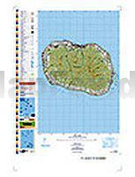
 | PI12 Rarotonga (Cookinseln) Topographische Landkarte 1:25.000 - Land Information New Zealand |
 | Le Vie del Sale (Blatt 7) - Il Novese e le Valli Scrivia, Borbera, Spinti e Lemme - Wanderkarte Italien 1:25.000 dal basso Piemonte al Mare - Topographische Wanderkarte Studio Cartografico Italiano - Italien |
 | 1222 COSSONAY 1:25.000 - Col du Mollendruz - L`Isle - La Sarraz - Topographische Landeskarte der Schweiz - swisstopo |
 | Kirgistan - Kyrgyz Gebiet - Kungey Ala - Too Gebiet 1:100.000 Topographische Trekkingkarte Kirgisistan Kyrgyzstan: Kyrgyz Range - Kungey Ala - Too Range - Trekking Map - Kirgisistan Trekking Union |
 | 3213SB Vigneulles-lès-Hattonchâtel - Dieue-sur-Meuse GPS Amtliche Topographische Wanderkarte Frankreich 1:25.000 - série bleue (IGN) |
 | Allgäu 2: Ostallgäu und vorderes Lechtal - Rother Wanderführer - Bergverlag Rother |
 | Namen / Namur 1:150.000 Straßenkarte Belgien (Blatt 378) Michelin Local |
 | Mittelrheintal - Boppard Topographische Wanderkarte Rheinland-Pfalz mit Wanderwegen und Radwegen 1:25.000 - ProjektNord |
 | 2240SB Najac - Varen-Laguépie GPS Amtliche Topographische Wanderkarte Frankreich 1:25.000 - série bleue (IGN) |
 | F501 Freizeitkarte Baden-Baden - Murgtal - Albtal - Naturpark Schwarzwald - Blatt 1 Mitte/Nord 1:50.000 - Landesvermessungsamt Baden-Württemberg |
 | 1439SB Parentis-en-Born - Pissos GPS Amtliche Topographische Wanderkarte Frankreich 1:25.000 - série bleue (IGN) |
 | 2840OT ALES Topographische Wanderkarte Frankreich 1:25.000 TOP 25 IGN |
 | Nitra und Umgebung Wir erkunden die Slowakei - Dajama |
 | Bodensee bis Rätikon - Rother Wanderführer - Bergverlag Rother |
| Sechelt - TOPO (Blatt VCBC9) Topographische Landkarte - Backroad Topo Map Kanada |
| 2116SB Maintenon - Auneau - GPS Amtliche Topographische Wanderkarte Frankreich 1:25.000 - série bleue (IGN) |
 | Finnland Straßenkarte 1:1.2 Mio. Jana Seta Suomi Tiekartta |
 | Valea Ariesului de la Albac la Vartop 1:35.000 (Blatt 6) wasserfeste Karte, rumänisch - englisch Valea Arieşului de la Albac la Vârtop - Harta turistica / Tourist map Zenith - Rumänien |
 | Québec 1:1 Mio. Straßenkarte (Blatt 760) Michelin |
 | 1619 Tönning Topographische Landkarte 1:25.000 Landesvermessungsamt Schleswig-Holstein |