| << Cookinseln - Tokelau-Inseln - Niue - Kermadecinseln |
||
|
||
Zuletzt angesehene Artikel:
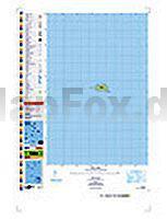
 | PI14 Takutea (Cookinseln) Topographische Landkarte 1:25.000 - Land Information New Zealand |
 | 3024OT BEAUNE - CHAGNY Topographische Wanderkarte Frankreich 1:25.000 TOP 25 IGN - (GPS) |
 | 1829 Eutin Topographische Landkarte 1:25.000 Landesvermessungsamt Schleswig-Holstein |
 | 4232 Quedlinburg Topographische Karte 1:25.000 Landesamt für Vermessung und Geoinformation Sachsen-Anhalt (Landesvermessungsamt) |
| 2045SB Cazères - Lézat-sur-Lèze GPS Amtliche Topographische Wanderkarte Frankreich 1:25.000 - série bleue (IGN) |
 | 2541OT Millau / St-Affrique - PNR Grands Causses GPS Topographische Wanderkarte Frankreich 1:25.000 TOP 25 IGN - (GPS) |
| Mailand 1:12.000 Stadtplan - ITMB International Travel Maps Milan |
| 1533SB JONZAC-MIRAMBEAU GPS Amtliche Topographische Wanderkarte Frankreich 1:25.000 - série bleue (IGN) |
| 2211SB Gournay-en-Bray - Lachapelle-aux-Pots GPS Amtliche Topographische Wanderkarte Frankreich 1:25.000 - série bleue (IGN) |
| Dinkelsbühl 1975 (Blatt 146) Historischer Bildstadtplan Bollmann-Bildkarten-Verlag |
 | 3033SB Vienne - Roussillon GPS Amtliche Topographische Wanderkarte Frankreich 1:25.000 - série bleue (IGN) |
| 1942SB Beaumont-de-Lomagne - St-Clar - GPS Amtliche Topographische Wanderkarte Frankreich 1:25.000 - série bleue (IGN) |
 | Prümer Land - Topographische Wanderkarte 1:25.000 (Blatt 17) Offizielle Wanderkarte des Eifelvereins - Kartengrundlage Landesvermessungsamt Rheinland-Pfalz |
| Liard River Yukon - Topographic Map pack of Canada 14 topographische Landkarten 1:50.000 - Kanada |
| 1663 Beelkow Topographische Karte 1:25.000 Messtischblatt des Deutschen Reiches - Preußische Landesaufnahme / Reichsamt für Landesaufnahme - Faksimile ProjektNord |
 | TS06 Bathurst 1:50.000 Topographische Landkarte Tasmanien - Australien - Tasmap (Tasmanien) |
 | Wingst Topographische Wanderkarte mit Wanderwegen und Radwegen 1:25.000 Niedersachsen - ProjektNord |
 | Baltische Staaten 1:500.000 Straßenkarte (Blatt 781) Michelin |
 | 0717SB Carhaix-Plouguer - Maël-Carhaix GPS Amtliche Topographische Wanderkarte Frankreich 1:25.000 - série bleue (IGN) |
 | Rheinbach - südliche Ville - Topographische Wanderkarte 1:25.000 (Blatt 6) Offizielle Wanderkarte des Eifelvereins - Kartengrundlage Landesvermessungsamt Rheinland-Pfalz |